Zhaobaoshan night lights from space
Night Light of Zhaobaoshan (Zhejiang) from space (China) Src. Average luminocity for 10x10km area is 86.8845% and for 50x50km: 49.7322%.
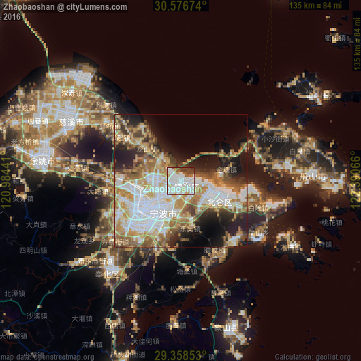
Analysis of Zhaobaoshan night lights 2016
Square area 10x10 km:
 39.58%
90-99
31.25%80-89
5.68%70-79
3.79%60-69
2.08%50-59
6.06%40-49
5.3%30-39
5.49%20-29
0.76%10-19
0%0-9
0%Square area 50x50 km:
13.56%90-99
9.68%80-89
6.5%70-79
7.65%60-69
7.18%50-59
6.03%40-49
5.47%30-39
4.17%20-29
6.9%10-19
11.59%0-9
21.26%Clear (daylight) street map image can be seen on geolist.org.
Map coordinates:
30° 34' 36.3" North, 120° 59' 3.9" East
29° 58' 10.2" North, 121° 41' 15.1" East
29° 21' 30.7" North, 122° 23' 26.4" East
Some cities around Zhaobaoshan sort by population:
• Ningbo
16.7 km =10.4 mi,  232°
232°
• Shangyu
78.8 km =49 mi,  273°
273°
• Lianghu
76 km =47.2 mi, 271°
• Yuyao
52.6 km =32.7 mi,  279°
279°
• Shenjiamen
58.8 km =36.5 mi,  91°
91°
• Zhoushan
49.9 km =31 mi, 87°
• Fenghua
44.1 km =27.4 mi,  217°
217°
• Ninghai
79.8 km =49.6 mi,  198°
198°
1784647 (p: 61,979)
Sources (retrieved 2019-11-25):
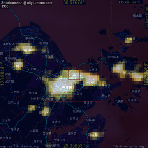
» NASA, Earths city lights 1995
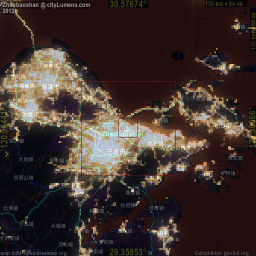
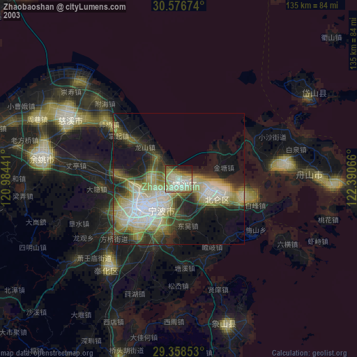
» NASA city lights 2003
» Earth at Night: Flat Maps 2012, 2016