Ningbo night lights from space
Night Light of Ningbo (Zhejiang) from space (China) Src. Average luminocity for 10x10km area is 98.6647% and for 50x50km: 50.3403%.
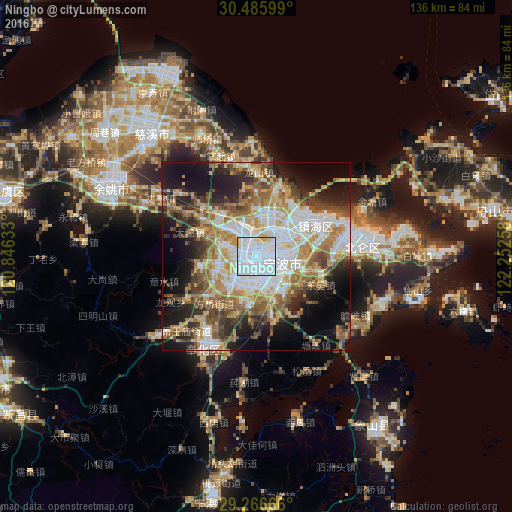
Analysis of Ningbo night lights 2016
Square area 10x10 km:
 78.97%
90-99
15.48%80-89
4.37%70-79
1.19%60-69
0%50-59
0%40-49
0%30-39
0%20-29
0%10-19
0%0-9
0%Square area 50x50 km:
12%90-99
8.89%80-89
6.29%70-79
8.12%60-69
7.44%50-59
7.27%40-49
6.96%30-39
5.16%20-29
8.52%10-19
13.89%0-9
15.45%Clear (daylight) street map image can be seen on geolist.org.
Map coordinates:
30° 29' 9.6" North, 120° 50' 46.8" East
29° 52' 41.5" North, 121° 32' 58" East
29° 15' 60" North, 122° 15' 9.3" East
Some cities around Ningbo sort by population:
• Shangyu
67.1 km =41.7 mi,  283°
283°
• Lianghu
64 km =39.8 mi, 281°
• Yuyao
43 km =26.7 mi,  296°
296°
• Shenjiamen
72.7 km =45.2 mi,  83°
83°
• Zhoushan
64.3 km =40 mi, 78°
• Fenghua
28.3 km =17.6 mi,  209°
209°
• Ninghai
66.6 km =41.4 mi,  190°
190°
• Zhaobaoshan
16.7 km =10.4 mi,  52°
52°
1799397 (p: 3,491,597)
Sources (retrieved 2019-11-25):
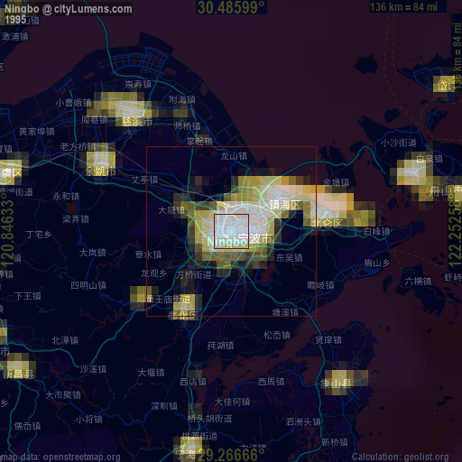
» NASA, Earths city lights 1995
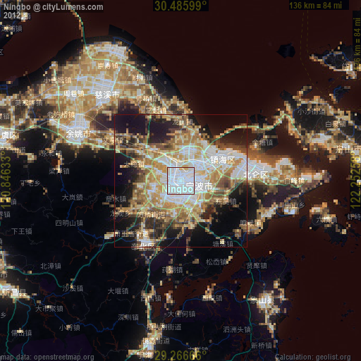
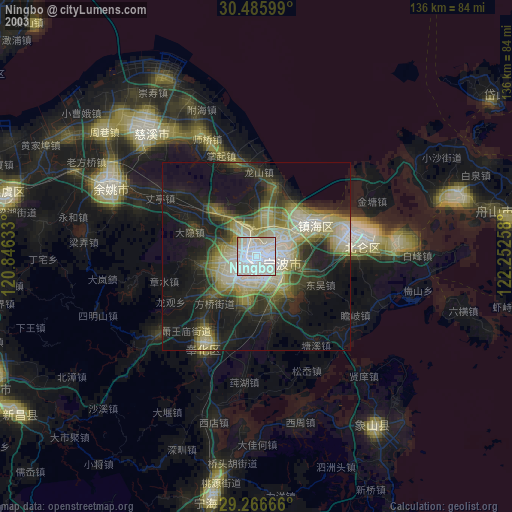
» NASA city lights 2003
» Earth at Night: Flat Maps 2012, 2016