Ninghai night lights from space
Night Light of Ninghai (Zhejiang) from space (China) Src. Average luminocity for 10x10km area is 37.892% and for 50x50km: 8.2145%.
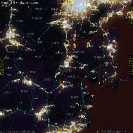
Analysis of Ninghai night lights 2016
Square area 10x10 km:
 5.87%
5.87%90-99
8.9%80-89
4.36%70-79
4.17%60-69
4.73%50-59
1.89%40-49
5.87%30-39
2.46%20-29
14.58%10-19
32.01%0-9
15.15%Square area 50x50 km:
0.43%90-99
0.77%80-89
1.05%70-79
1.34%60-69
1.37%50-59
1.22%40-49
1.58%30-39
1.02%20-29
1.88%10-19
6.97%0-9
82.36%Clear (daylight) street map image can be seen on geolist.org.
Map coordinates:
29° 54' 2" North, 120° 43' 17.8" East
29° 17' 21" North, 121° 25' 29" East
28° 40' 26.8" North, 122° 7' 40.3" East
Some cities around Ninghai sort by population:
• Ningbo
66.6 km =41.4 mi,  10°
10°
• Jiaojiang
65.9 km =40.9 mi,  175°
175°
• Luqiao
79 km =49.1 mi, 183°
• Linhai
55.4 km =34.4 mi,  209°
209°
• Huangyan
72.7 km =45.2 mi,  192°
192°
• Fenghua
40.9 km =25.4 mi,  357°
357°
• Zhaobaoshan
79.8 km =49.6 mi,  18°
18°
• Xianju
82.9 km =51.5 mi,  234°
234°
1799384 (p: 68,330)
Sources (retrieved 2019-11-25):
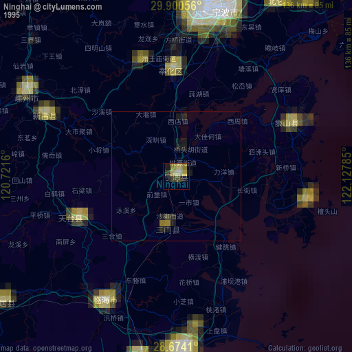
» NASA, Earths city lights 1995
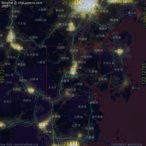
» NASA city lights 2003
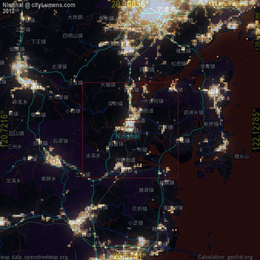
» Earth at Night: Flat Maps 2012, 2016