Lianghu night lights from space
Night Light of Lianghu (Zhejiang) from space (China) Src. Average luminocity for 10x10km area is 43.1061% and for 50x50km: 28.9869%.
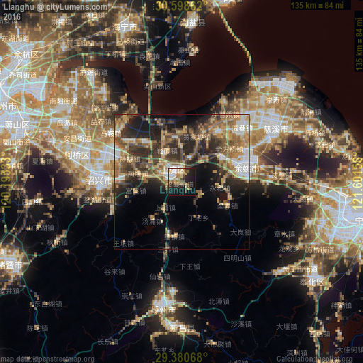
Analysis of Lianghu night lights 2016
Square area 10x10 km:
 7.2%
7.2%90-99
7.01%80-89
7.01%70-79
6.25%60-69
6.82%50-59
3.98%40-49
7.01%30-39
2.65%20-29
14.2%10-19
28.98%0-9
8.9%Square area 50x50 km:
2.57%90-99
3.12%80-89
4.55%70-79
4.6%60-69
5.52%50-59
5.82%40-49
5.71%30-39
5.94%20-29
9.86%10-19
10.99%0-9
41.33%Clear (daylight) street map image can be seen on geolist.org.
Map coordinates:
30° 35' 55" North, 120° 11' 43.2" East
29° 59' 29.5" North, 120° 53' 54.4" East
29° 22' 50.4" North, 121° 36' 5.7" East
Some cities around Lianghu sort by population:
• Ningbo
64 km =39.8 mi,  101°
101°
• Shangyu
3.8 km =2.4 mi,  315°
315°
• Shaoxing
30.8 km =19.1 mi,  272°
272°
• Yuyao
25 km =15.5 mi,  74°
74°
• Zhuji
70.2 km =43.6 mi,  244°
244°
• Xiaoshan
64.6 km =40.1 mi,  287°
287°
• Fenghua
61.6 km =38.3 mi,  127°
127°
• Haining
63.9 km =39.7 mi,  341°
341°
1919014 (p: 155,000)
Sources (retrieved 2019-11-25):
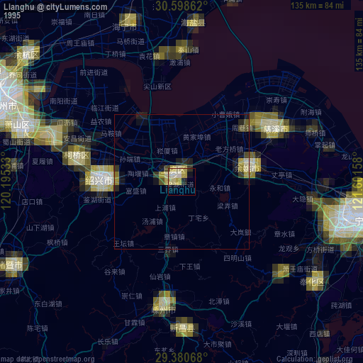
» NASA, Earths city lights 1995
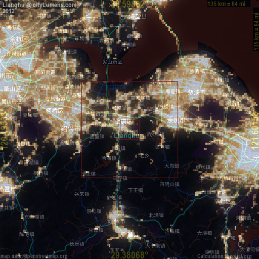
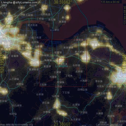
» NASA city lights 2003
» Earth at Night: Flat Maps 2012, 2016