Huangpi night lights from space
Night Light of Huangpi (Hubei) from space (China) Src. Average luminocity for 10x10km area is 25.1224% and for 50x50km: 15.6165%.
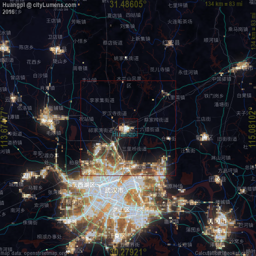
Analysis of Huangpi night lights 2016
Square area 10x10 km:
 3.32%
3.32%90-99
4.37%80-89
2.1%70-79
2.8%60-69
3.67%50-59
4.9%40-49
4.55%30-39
1.05%20-29
3.85%10-19
26.57%0-9
42.83%Square area 50x50 km:
1.64%90-99
2.29%80-89
2.14%70-79
2.21%60-69
2.94%50-59
3.31%40-49
3.7%30-39
2.4%20-29
2.65%10-19
7.03%0-9
69.69%Clear (daylight) street map image can be seen on geolist.org.
Map coordinates:
31° 29' 9.8" North, 113° 40' 29.2" East
30° 53' 4.3" North, 114° 22' 40.4" East
30° 16' 45.2" North, 115° 4' 51.7" East
Some cities around Huangpi sort by population:
• Wuhan
35.1 km =21.8 mi,  197°
197°
• Ezhou
69.3 km =43.1 mi,  141°
141°
• Xiaogan
43.7 km =27.2 mi,  276°
276°
• Macheng
69.6 km =43.2 mi,  61°
61°
• Hanchuan
64 km =39.8 mi,  245°
245°
• Xinzhou
40.3 km =25 mi,  92°
92°
• Caidian
47 km =29.2 mi,  224°
224°
• Yunmeng Chengguanzhen
61.6 km =38.3 mi,  288°
288°
1807308 (p: 57,554)
Sources (retrieved 2019-11-25):
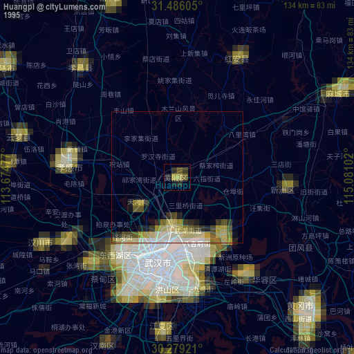
» NASA, Earths city lights 1995
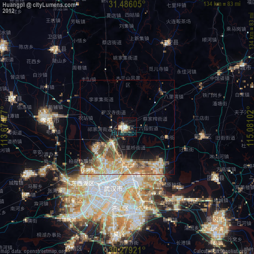
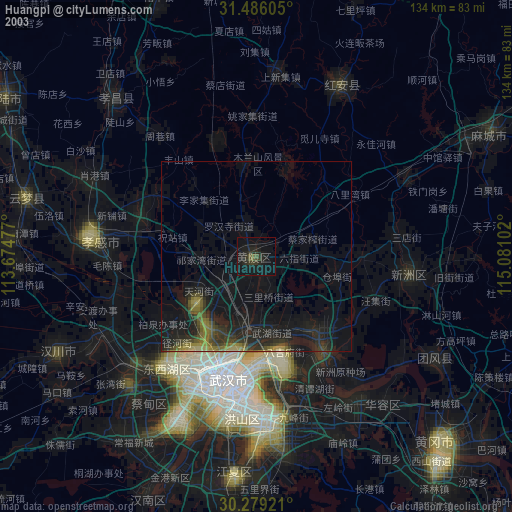
» NASA city lights 2003
» Earth at Night: Flat Maps 2012, 2016