Xiaogan night lights from space
Night Light of Xiaogan (Hubei) from space (China) Src. Average luminocity for 10x10km area is 50.278% and for 50x50km: 6.0068%.
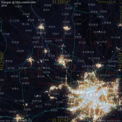
Analysis of Xiaogan night lights 2016
Square area 10x10 km:
 3.15%
3.15%90-99
7.87%80-89
6.29%70-79
13.99%60-69
12.59%50-59
9.44%40-49
7.52%30-39
4.72%20-29
10.31%10-19
19.76%0-9
4.37%Square area 50x50 km:
0.13%90-99
0.39%80-89
0.71%70-79
0.96%60-69
1.05%50-59
1.1%40-49
1.48%30-39
0.92%20-29
1.76%10-19
5.32%0-9
86.18%Clear (daylight) street map image can be seen on geolist.org.
Map coordinates:
31° 31' 41.3" North, 113° 13' 8.7" East
30° 55' 36.8" North, 113° 55' 20" East
30° 19' 18.6" North, 114° 37' 31.2" East
Some cities around Xiaogan sort by population:
• Wuhan
50.4 km =31.3 mi,  139°
139°
• Chengzhong
35.3 km =21.9 mi,  273°
273°
• Xinshi
75.7 km =47 mi,  280°
280°
• Hanchuan
34.2 km =21.3 mi,  205°
205°
• Caidian
39.6 km =24.6 mi,  164°
164°
• Anlu
43.5 km =27 mi,  327°
327°
• Yunmeng Chengguanzhen
21.2 km =13.2 mi,  315°
315°
• Huangpi
43.7 km =27.2 mi,  96°
96°
1790254 (p: 160,437)
Sources (retrieved 2019-11-25):
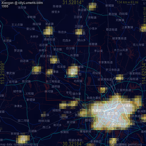
» NASA, Earths city lights 1995
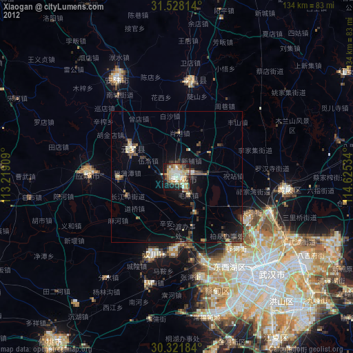
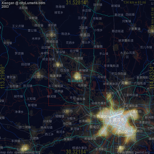
» NASA city lights 2003
» Earth at Night: Flat Maps 2012, 2016