Suizhou night lights from space
Night Light of Suizhou (Hubei) from space (China) Src. Average luminocity for 10x10km area is 44.7033% and for 50x50km: 3.1637%.
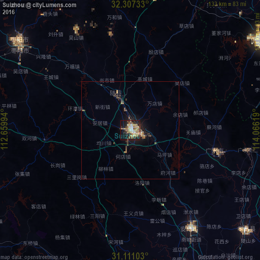

Analysis of Suizhou night lights 2016
Square area 10x10 km:
 3.85%
3.85%90-99
5.49%80-89
11.72%70-79
6.78%60-69
11.9%50-59
4.95%40-49
3.85%30-39
5.31%20-29
10.07%10-19
25.09%0-9
10.99%Square area 50x50 km:
0.16%90-99
0.26%80-89
0.53%70-79
0.43%60-69
0.69%50-59
0.44%40-49
0.44%30-39
0.59%20-29
0.78%10-19
2.72%0-9
92.96%Clear (daylight) street map image can be seen on geolist.org.
Map coordinates:
32° 18' 26.4" North, 112° 39' 35.8" East
31° 42' 40" North, 113° 21' 47" East
31° 6' 39.7" North, 114° 3' 58.3" East
Some cities around Suizhou sort by population:
• Xinyang
80.6 km =50.1 mi,  55°
55°
• Chengzhong
87.1 km =54.1 mi,  168°
168°
• Zaoyang
73.8 km =45.9 mi,  308°
308°
• Guangshui
60.9 km =37.8 mi,  99°
99°
• Xinshi
76.8 km =47.7 mi,  195°
195°
• Xihe
10.1 km =6.3 mi,  105°
105°
• Anlu
58.6 km =36.4 mi,  149°
149°
• Yunmeng Chengguanzhen
81.6 km =50.7 mi, 152°
1793879 (p: 323,945)
Sources (retrieved 2019-11-25):
» NASA, Earths city lights 1995
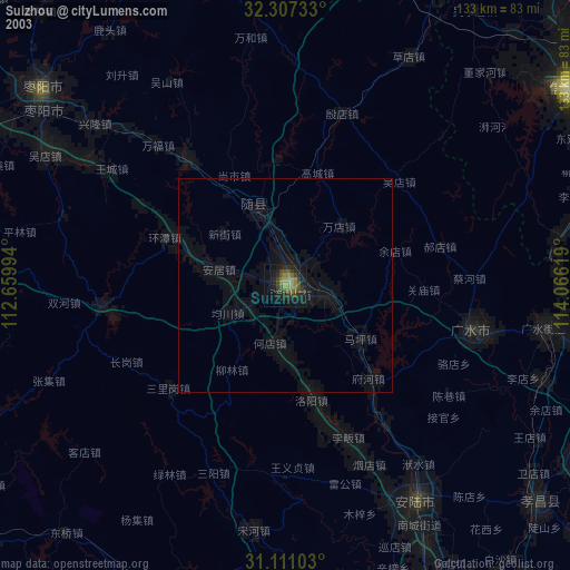
» NASA city lights 2003
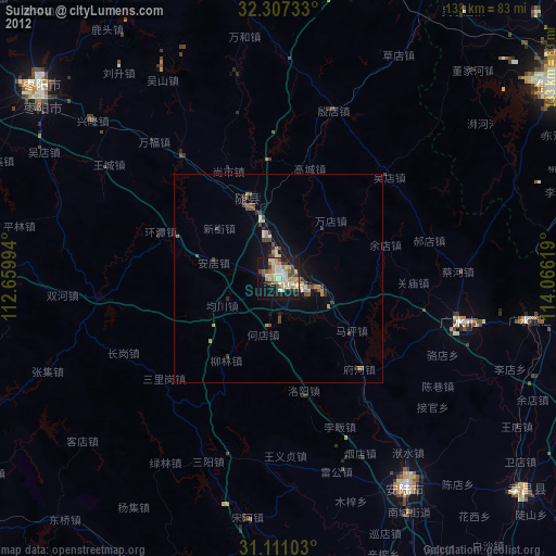
» Earth at Night: Flat Maps 2012, 2016