Xinyang night lights from space
Night Light of Xinyang (Henan) from space (China) Src. Average luminocity for 10x10km area is 70.3689% and for 50x50km: 6.3312%.
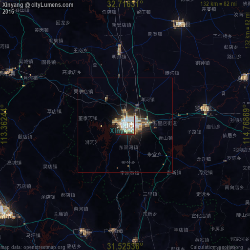
Analysis of Xinyang night lights 2016
Square area 10x10 km:
 21.15%
90-99
22.9%80-89
9.97%70-79
6.64%60-69
5.94%50-59
2.8%40-49
6.29%30-39
4.02%20-29
12.06%10-19
7.69%0-9
0.52%Square area 50x50 km:
1.14%90-99
1.43%80-89
0.7%70-79
0.54%60-69
0.74%50-59
0.52%40-49
0.93%30-39
0.87%20-29
2%10-19
3.73%0-9
87.41%Clear (daylight) street map image can be seen on geolist.org.
Map coordinates:
32° 42' 58.7" North, 113° 21' 44.8" East
32° 7' 22" North, 114° 3' 56" East
31° 31' 31.3" North, 114° 46' 7.3" East
Some cities around Xinyang sort by population:
• Zhumadian
95.3 km =59.2 mi,  357°
357°
• Suizhou
80.6 km =50.1 mi,  235°
235°
• Guangshui
56.3 km =35 mi,  186°
186°
• Xihe
74.6 km =46.4 mi,  229°
229°
• Dingcheng
91.7 km =57 mi,  89°
89°
• Anlu
102.9 km =63.9 mi,  200°
200°
• Minggang
37.4 km =23.2 mi, 357°
• Runing
101.3 km =62.9 mi,  15°
15°
1788534 (p: 1,590,668)
Sources (retrieved 2019-11-25):
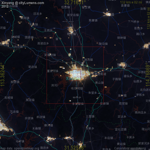
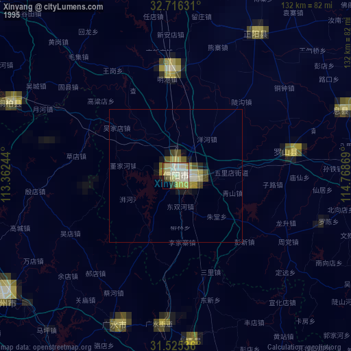
» NASA, Earths city lights 1995
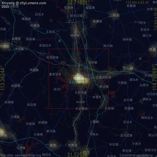
» NASA city lights 2003
» Earth at Night: Flat Maps 2012, 2016