Leiyang night lights from space
Night Light of Leiyang (Hunan) from space (China) Src. Average luminocity for 10x10km area is 30.4337% and for 50x50km: 1.5196%.
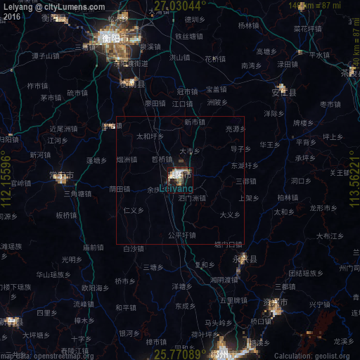
Analysis of Leiyang night lights 2016
Square area 10x10 km:
 6.06%
6.06%90-99
5.68%80-89
3.98%70-79
1.7%60-69
3.22%50-59
2.84%40-49
7.01%30-39
4.92%20-29
4.17%10-19
23.48%0-9
36.93%Square area 50x50 km:
0.25%90-99
0.23%80-89
0.16%70-79
0.07%60-69
0.13%50-59
0.12%40-49
0.35%30-39
0.24%20-29
0.23%10-19
1.49%0-9
96.74%Clear (daylight) street map image can be seen on geolist.org.
Map coordinates:
27° 1' 49.6" North, 112° 9' 21.5" East
26° 24' 8.6" North, 112° 51' 32.7" East
25° 46' 15.2" North, 113° 33' 44" East
Some cities around Leiyang sort by population:
• Hengyang
59.2 km =36.8 mi,  336°
336°
• Chenzhou
69.2 km =43 mi,  165°
165°
• Lecheng
150 km =93.2 mi,  160°
160°
• Lengshuitan
125.8 km =78.2 mi,  270°
270°
• Yongfeng
132.3 km =82.2 mi,  329°
329°
• Wuxi
101.6 km =63.1 mi,  281°
281°
• Hongqiao
85 km =52.8 mi,  298°
298°
• Bojia
89 km =55.3 mi, 274°
1804208 (p: 129,116)
Sources (retrieved 2019-11-25):
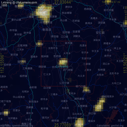
» NASA, Earths city lights 1995
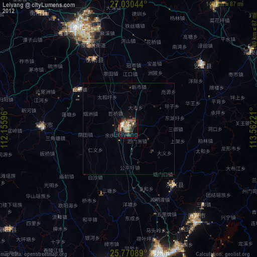
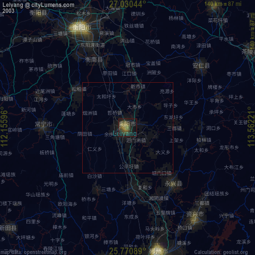
» NASA city lights 2003
» Earth at Night: Flat Maps 2012, 2016