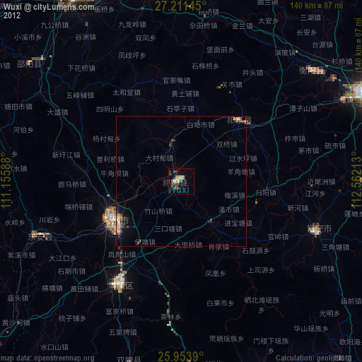
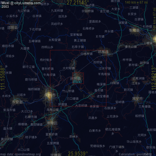
Wuxi night lights from space
Night Light of Wuxi (Hunan) from space (China) Src. Average luminocity for 10x10km area is 20.0758% and for 50x50km: 2.4329%.
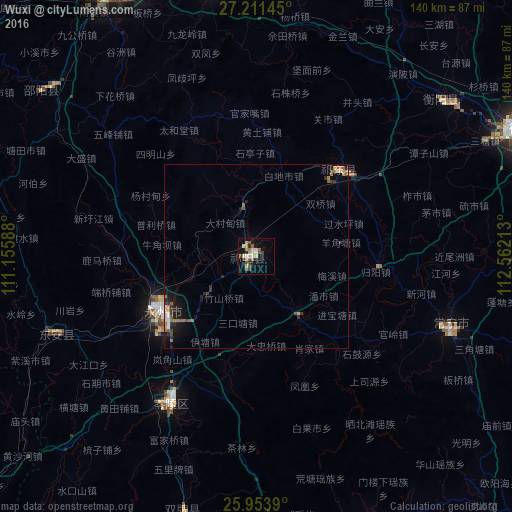

Analysis of Wuxi night lights 2016
Square area 10x10 km:
 1.52%
1.52%90-99
3.03%80-89
3.6%70-79
1.7%60-69
4.17%50-59
1.33%40-49
5.3%30-39
2.84%20-29
2.65%10-19
8.14%0-9
65.72%Square area 50x50 km:
0.19%90-99
0.21%80-89
0.29%70-79
0.16%60-69
0.56%50-59
0.35%40-49
0.43%30-39
0.47%20-29
0.59%10-19
1.65%0-9
95.1%Clear (daylight) street map image can be seen on geolist.org.
Map coordinates:
27° 12' 41.2" North, 111° 9' 21.2" East
26° 35' 3.8" North, 111° 51' 32.4" East
25° 57' 14" North, 112° 33' 43.7" East
Some cities around Wuxi sort by population:
• Hengyang
82.7 km =51.4 mi,  65°
65°
• Leiyang
101.6 km =63.1 mi,  101°
101°
• Lengshuitan
32.5 km =20.2 mi,  233°
233°
• Yongfeng
99.2 km =61.6 mi,  18°
18°
• Lianyuan
124.3 km =77.2 mi,  351°
351°
• Hongqiao
32.1 km =19.9 mi,  50°
50°
• Bojia
17 km =10.6 mi,  140°
140°
• Shijiang
119.3 km =74.1 mi,  297°
297°
1797417 (p: 66,442)
Sources (retrieved 2019-11-25):
» NASA, Earths city lights 1995
» NASA city lights 2003
» Earth at Night: Flat Maps 2012, 2016