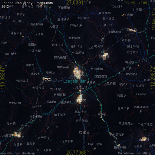
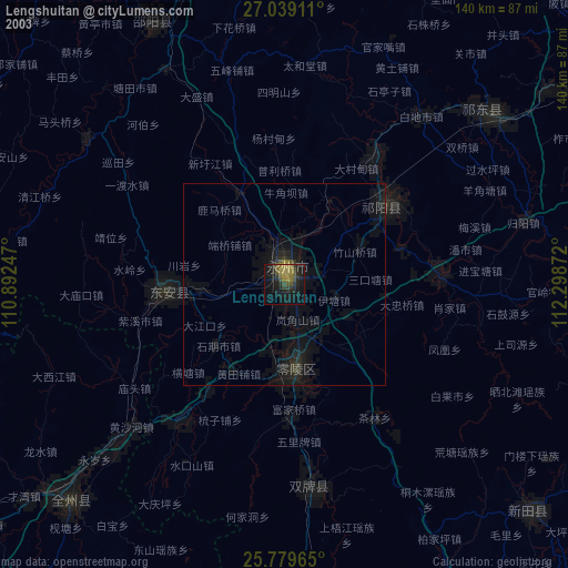
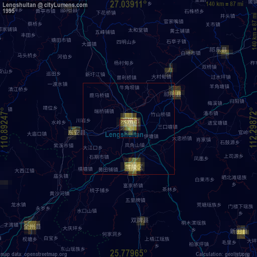
Lengshuitan night lights from space
Night Light of Lengshuitan (Hunan) from space (China) Src. Average luminocity for 10x10km area is 35.322% and for 50x50km: 4.2203%.
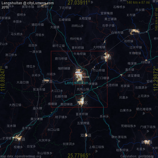
Analysis of Lengshuitan night lights 2016
Square area 10x10 km:
 5.68%
5.68%90-99
5.11%80-89
4.17%70-79
4.36%60-69
6.06%50-59
6.25%40-49
5.11%30-39
3.41%20-29
6.63%10-19
29.73%0-9
23.48%Square area 50x50 km:
0.61%90-99
0.54%80-89
0.42%70-79
0.47%60-69
0.62%50-59
0.56%40-49
0.66%30-39
0.47%20-29
0.63%10-19
3.8%0-9
91.23%Clear (daylight) street map image can be seen on geolist.org.
Map coordinates:
27° 2' 20.8" North, 110° 53' 32.9" East
26° 24' 40" North, 111° 35' 44.1" East
25° 46' 46.7" North, 112° 17' 55.4" East
Some cities around Lengshuitan sort by population:
• Hengyang
114.8 km =71.3 mi,  62°
62°
• Leiyang
125.8 km =78.2 mi,  90°
90°
• Yongfeng
127.2 km =79 mi,  27°
27°
• Wuxi
32.5 km =20.2 mi,  53°
53°
• Hongqiao
64.6 km =40.1 mi, 52°
• Bojia
37.6 km =23.4 mi,  80°
80°
• Shijiang
109.1 km =67.8 mi,  313°
313°
• Liuduzhai
124.8 km =77.5 mi,  328°
328°
1804162 (p: 88,935)
Sources (retrieved 2019-11-25):
» NASA, Earths city lights 1995
» NASA city lights 2003
» Earth at Night: Flat Maps 2012, 2016