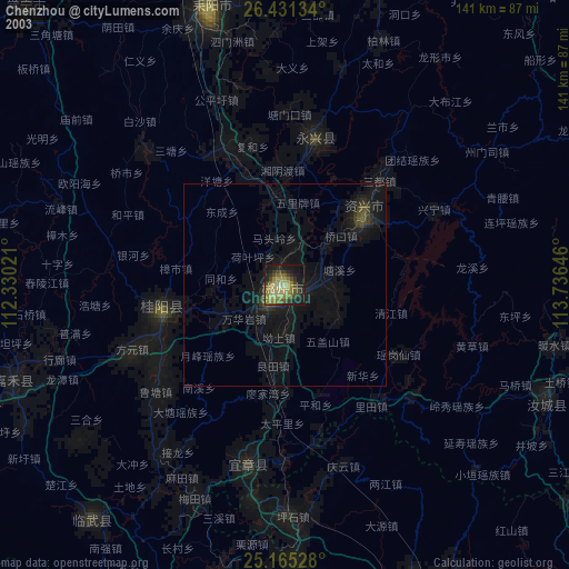
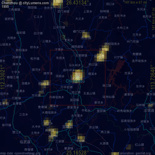
Chenzhou night lights from space
Night Light of Chenzhou (Hunan) from space (China) Src. Average luminocity for 10x10km area is 59.303% and for 50x50km: 6.5737%.
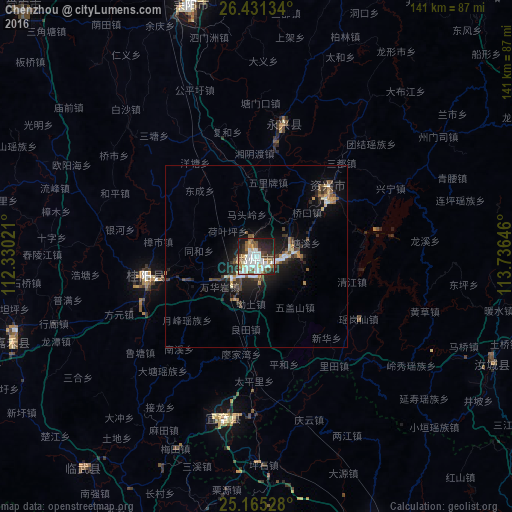

Analysis of Chenzhou night lights 2016
Square area 10x10 km:
 15.72%
90-99
18.37%80-89
2.65%70-79
2.27%60-69
7.95%50-59
8.14%40-49
9.47%30-39
6.63%20-29
15.34%10-19
13.45%0-9
0%Square area 50x50 km:
0.88%90-99
1.19%80-89
0.35%70-79
0.68%60-69
0.68%50-59
0.87%40-49
1.28%30-39
1.22%20-29
2.18%10-19
4.77%0-9
85.9%Clear (daylight) street map image can be seen on geolist.org.
Map coordinates:
26° 25' 52.8" North, 112° 19' 48.8" East
25° 48' 0" North, 113° 1' 60" East
25° 9' 55" North, 113° 44' 11.3" East
Some cities around Chenzhou sort by population:
• Hengyang
128 km =79.5 mi,  341°
341°
• Shaoguan
124.2 km =77.2 mi,  153°
153°
• Leiyang
69.2 km =43 mi,  345°
345°
• Lecheng
81.2 km =50.5 mi,  156°
156°
• Maba
136.5 km =84.8 mi, 155°
• Lianzhou
131.3 km =81.6 mi,  210°
210°
• Shixing
140.5 km =87.3 mi,  132°
132°
• Bojia
129.7 km =80.6 mi,  304°
304°
1815059 (p: 179,038)
Sources (retrieved 2019-11-25):
» NASA, Earths city lights 1995
» NASA city lights 2003
» Earth at Night: Flat Maps 2012, 2016