Huayin night lights from space
Night Light of Huayin (Shaanxi) from space (China) Src. Average luminocity for 10x10km area is 27.0997% and for 50x50km: 3.3786%.
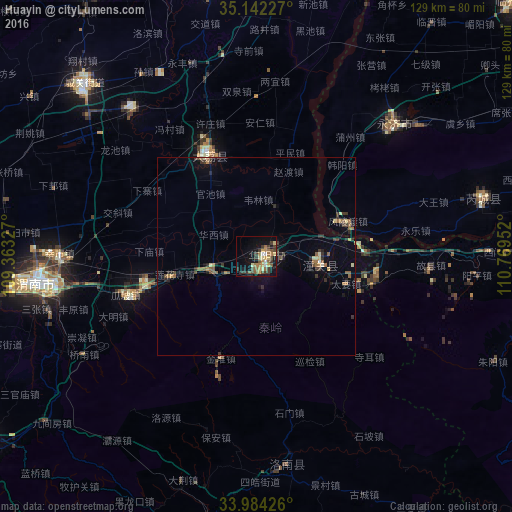
Analysis of Huayin night lights 2016
Square area 10x10 km:
 1.22%
1.22%90-99
2.62%80-89
4.72%70-79
3.32%60-69
6.82%50-59
5.07%40-49
4.02%30-39
8.57%20-29
1.57%10-19
20.98%0-9
41.08%Square area 50x50 km:
0.07%90-99
0.22%80-89
0.36%70-79
0.32%60-69
0.78%50-59
0.66%40-49
0.41%30-39
1.06%20-29
0.64%10-19
1.61%0-9
93.88%Clear (daylight) street map image can be seen on geolist.org.
Map coordinates:
35° 8' 32.2" North, 109° 21' 47.8" East
34° 33' 55" North, 110° 3' 59" East
33° 59' 3.3" North, 110° 46' 10.3" East
Some cities around Huayin sort by population:
• Xi’an
109.8 km =68.2 mi,  251°
251°
• Xianyang
127.6 km =79.3 mi,  258°
258°
• Tongchuanshi
106 km =65.9 mi,  302°
302°
• Yuncheng
98.7 km =61.3 mi,  58°
58°
• Weinan
51.5 km =32 mi, 262°
• Lintong
81.3 km =50.5 mi, 255°
• Yanliang
77.3 km =48 mi,  277°
277°
• Hancheng
104.9 km =65.2 mi,  18°
18°
1806988 (p: 242,488)
Sources (retrieved 2019-11-25):
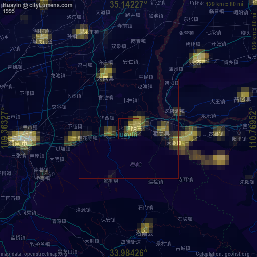
» NASA, Earths city lights 1995
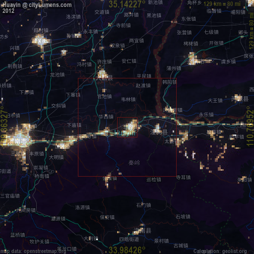
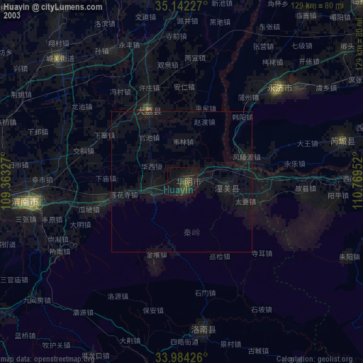
» NASA city lights 2003
» Earth at Night: Flat Maps 2012, 2016