Yuncheng night lights from space
Night Light of Yuncheng (Shanxi) from space (China) Src. Average luminocity for 10x10km area is 63.6801% and for 50x50km: 9.5093%.

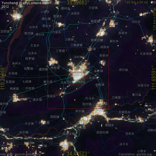


Analysis of Yuncheng night lights 2016
Square area 10x10 km:
 13.46%
90-99
17.31%80-89
11.19%70-79
8.22%60-69
8.22%50-59
4.72%40-49
6.29%30-39
7.17%20-29
14.16%10-19
8.57%0-9
0.7%Square area 50x50 km:
0.69%90-99
1.52%80-89
1.61%70-79
1.3%60-69
1.57%50-59
1.03%40-49
1.11%30-39
1.63%20-29
2.74%10-19
6.55%0-9
80.25%Clear (daylight) street map image can be seen on geolist.org.
Map coordinates:
35° 35' 48.6" North, 110° 17' 22.8" East
35° 1' 23" North, 110° 59' 34" East
34° 26' 42.8" North, 111° 41' 45.3" East
Some cities around Yuncheng sort by population:
• Luoyang
138.5 km =86.1 mi,  105°
105°
• Changzhi
70.9 km =44.1 mi,  73°
73°
• Huayin
98.7 km =61.3 mi,  238°
238°
• Linfen
127.7 km =79.3 mi,  21°
21°
• Weinan
147.3 km =91.5 mi,  246°
246°
• Yima
87.2 km =54.2 mi, 111°
• Yanliang
165.9 km =103.1 mi,  255°
255°
• Hancheng
70.6 km =43.9 mi,  313°
313°
1785738 (p: 201,950)
Sources (retrieved 2019-11-25):
» NASA, Earths city lights 1995
» NASA city lights 2003
» Earth at Night: Flat Maps 2012, 2016