Xi’an night lights from space
Night Light of Xi’an (Shaanxi) from space (China) Src. Average luminocity for 10x10km area is 99.511% and for 50x50km: 59.5129%.
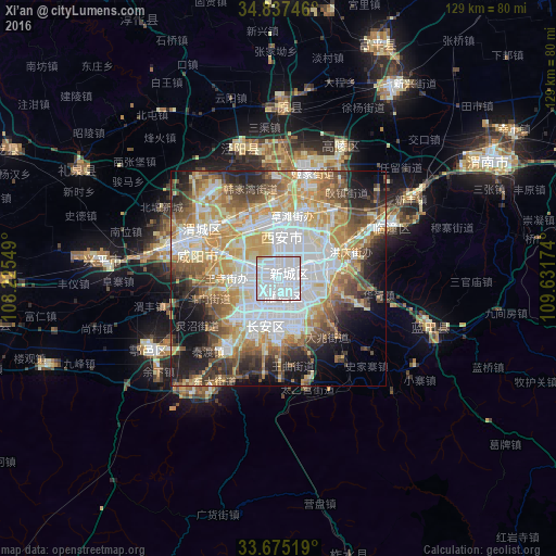
Analysis of Xi’an night lights 2016
Square area 10x10 km:
 82.05%
90-99
16.48%80-89
1.1%70-79
0.37%60-69
0%50-59
0%40-49
0%30-39
0%20-29
0%10-19
0%0-9
0%Square area 50x50 km:
17.04%90-99
11.29%80-89
8.03%70-79
10.42%60-69
7.76%50-59
7%40-49
6.75%30-39
5.22%20-29
6.78%10-19
9.39%0-9
10.32%Clear (daylight) street map image can be seen on geolist.org.
Map coordinates:
34° 50' 14.9" North, 108° 13' 31.8" East
34° 15' 30" North, 108° 55' 43" East
33° 40' 30.7" North, 109° 37' 54.3" East
Some cities around Xi’an sort by population:
• Xianyang
22.6 km =14 mi,  293°
293°
• Huayin
109.8 km =68.2 mi,  71°
71°
• Tongchuanshi
91.9 km =57.1 mi,  8°
8°
• Weinan
59.8 km =37.2 mi,  62°
62°
• Guozhen
144.6 km =89.9 mi,  274°
274°
• Lintong
29 km =18 mi, 62°
• Yanliang
52.4 km =32.6 mi,  31°
31°
• Yuxia
35.2 km =21.9 mi,  231°
231°
1790630 (p: 6,501,190)
Sources (retrieved 2019-11-25):
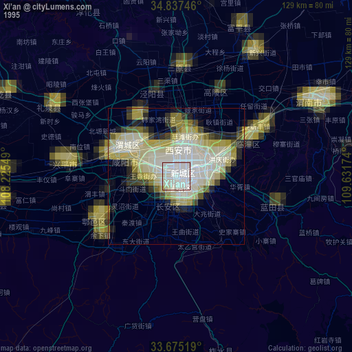
» NASA, Earths city lights 1995
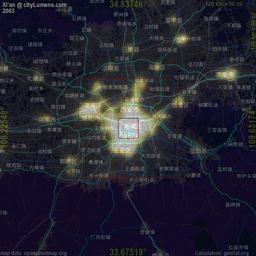
» NASA city lights 2003
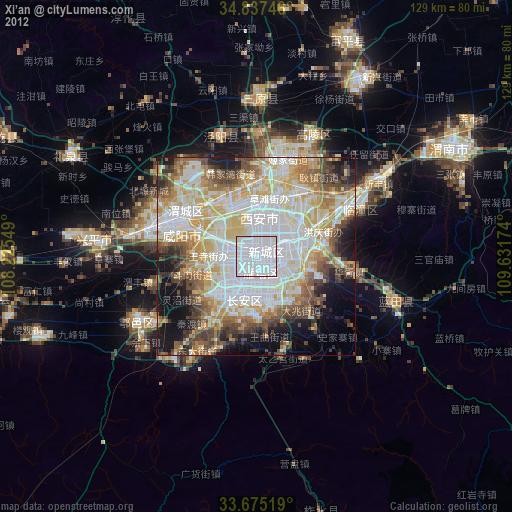
» Earth at Night: Flat Maps 2012, 2016