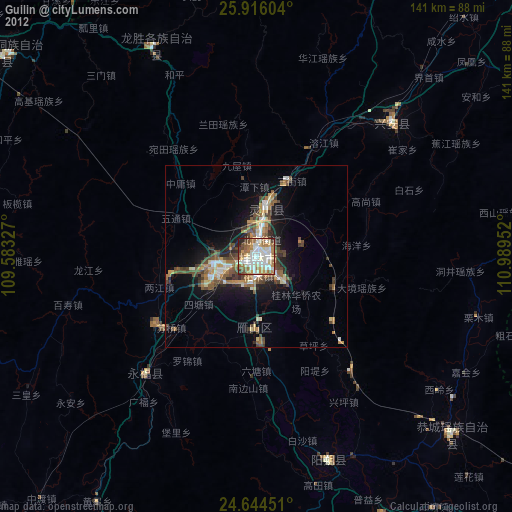
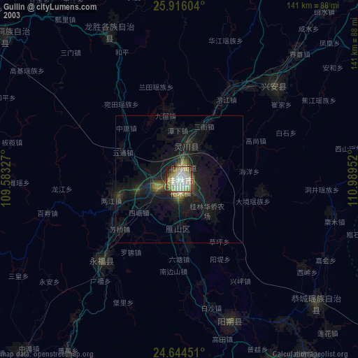
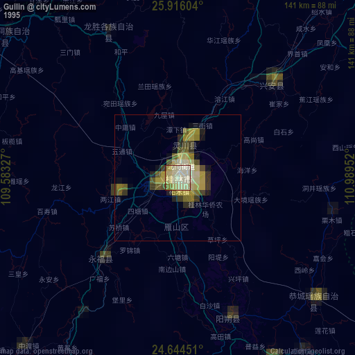
Guilin night lights from space
Night Light of Guilin (Guangxi) from space (China) Src. Average luminocity for 10x10km area is 76.5357% and for 50x50km: 11.4404%.
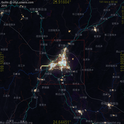
Analysis of Guilin night lights 2016
Square area 10x10 km:
 24.01%
90-99
23.41%80-89
8.73%70-79
4.37%60-69
9.13%50-59
10.91%40-49
7.54%30-39
9.33%20-29
2.58%10-19
0%0-9
0%Square area 50x50 km:
1.88%90-99
2.02%80-89
1.07%70-79
1.36%60-69
1.27%50-59
1.57%40-49
1.92%30-39
2.44%20-29
2.63%10-19
6.78%0-9
77.06%Clear (daylight) street map image can be seen on geolist.org.
Map coordinates:
25° 54' 57.7" North, 109° 34' 59.8" East
25° 16' 55" North, 110° 17' 11" East
24° 38' 40.2" North, 110° 59' 22.3" East
Some cities around Guilin sort by population:
• Yangshuo
59.4 km =36.9 mi,  159°
159°
• Lengshuitan
181.5 km =112.8 mi,  46°
46°
• Luorong
119 km =73.9 mi,  215°
215°
• Babu
157 km =97.6 mi,  127°
127°
• Pingnan
193.7 km =120.4 mi,  176°
176°
• Laibin
203.9 km =126.7 mi,  210°
210°
• Hongjiang
205.3 km =127.6 mi,  351°
351°
• Shuangjiang
112.7 km =70 mi,  329°
329°
1809498 (p: 649,352)
Sources (retrieved 2019-11-25):
» NASA, Earths city lights 1995
» NASA city lights 2003
» Earth at Night: Flat Maps 2012, 2016