Laibin night lights from space
Night Light of Laibin (Guangxi) from space (China) Src. Average luminocity for 10x10km area is 22.6171% and for 50x50km: 4.1397%.
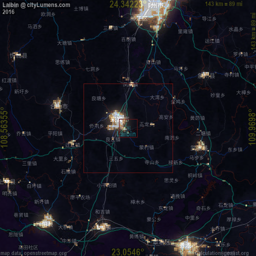
Analysis of Laibin night lights 2016
Square area 10x10 km:
 4.76%
4.76%90-99
2.58%80-89
1.19%70-79
2.18%60-69
4.56%50-59
2.58%40-49
4.37%30-39
3.17%20-29
5.16%10-19
17.86%0-9
51.59%Square area 50x50 km:
0.75%90-99
0.73%80-89
0.46%70-79
0.42%60-69
0.54%50-59
0.44%40-49
0.43%30-39
0.48%20-29
1.12%10-19
3.25%0-9
91.39%Clear (daylight) street map image can be seen on geolist.org.
Map coordinates:
24° 20' 32" North, 108° 33' 48.8" East
23° 42' 0" North, 109° 16' 0" East
23° 3' 16.6" North, 109° 58' 11.3" East
Some cities around Laibin sort by population:
• Nanning
138.1 km =85.8 mi,  224°
224°
• Yulin
149.1 km =92.6 mi,  142°
142°
• Guigang
75.7 km =47 mi,  152°
152°
• Guiping
89.1 km =55.4 mi,  112°
112°
• Luorong
85.8 km =53.3 mi,  23°
23°
• Pingnan
115.7 km =71.9 mi,  98°
98°
• Pumiao
131.9 km =82 mi, 217°
• Lingcheng
156.3 km =97.1 mi,  134°
134°
1804609 (p: 59,835)
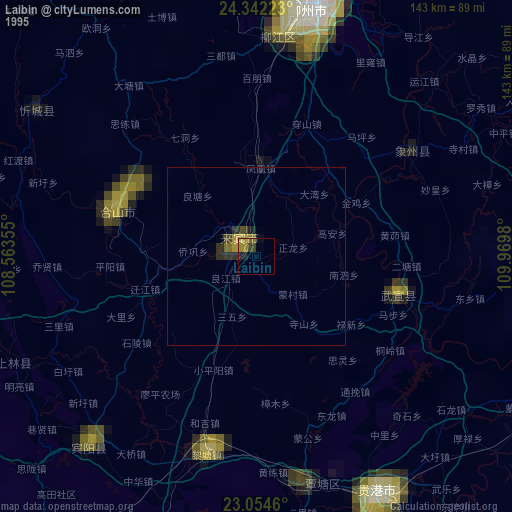
Sources (retrieved 2019-11-25):
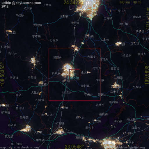
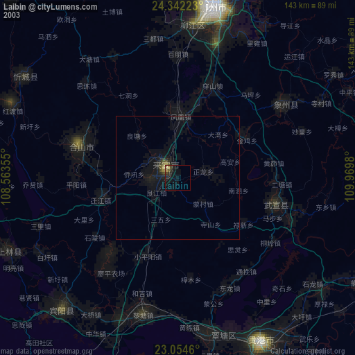
» NASA, Earths city lights 1995
» NASA city lights 2003
» Earth at Night: Flat Maps 2012, 2016