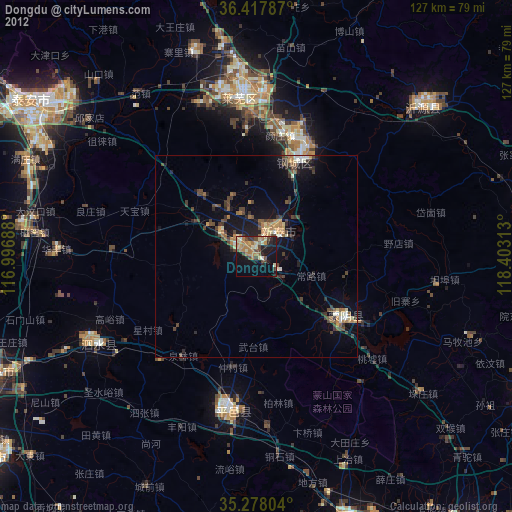
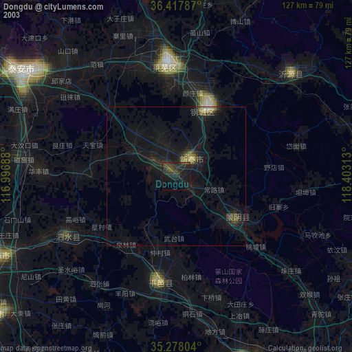
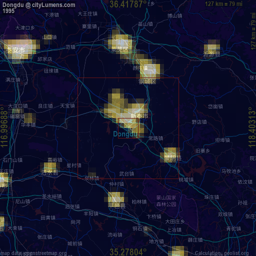
Dongdu night lights from space
Night Light of Dongdu (Shandong) from space (China) Src. Average luminocity for 10x10km area is 23.8619% and for 50x50km: 4.6273%.
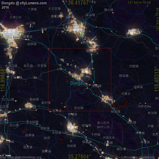
Analysis of Dongdu night lights 2016
Square area 10x10 km:
 0%
0%90-99
0.35%80-89
1.75%70-79
3.67%60-69
7.34%50-59
6.99%40-49
6.29%30-39
3.15%20-29
8.74%10-19
21.5%0-9
40.21%Square area 50x50 km:
0.07%90-99
0.1%80-89
0.27%70-79
0.66%60-69
0.93%50-59
1.34%40-49
1.08%30-39
1.26%20-29
1.26%10-19
3.79%0-9
89.24%Clear (daylight) street map image can be seen on geolist.org.
Map coordinates:
36° 25' 4.3" North, 116° 59' 48.8" East
35° 51' 0" North, 117° 42' 0" East
35° 16' 40.9" North, 118° 24' 11.3" East
Some cities around Dongdu sort by population:
• Tai’an
64.1 km =39.8 mi,  305°
305°
• Xintai
7.3 km =4.5 mi,  39°
39°
• Laiwu
38.3 km =23.8 mi,  354°
354°
• Sishui
44.3 km =27.5 mi,  239°
239°
• Feicheng
69.9 km =43.4 mi,  159°
159°
• Pingyi
39.4 km =24.5 mi,  189°
189°
• Nanma
55.3 km =34.4 mi,  47°
47°
• Mengyin
25.9 km =16.1 mi,  127°
127°
1812597 (p: 72,957)
Sources (retrieved 2019-11-25):
» NASA, Earths city lights 1995
» NASA city lights 2003
» Earth at Night: Flat Maps 2012, 2016