Dalai night lights from space
Night Light of Dalai (Jilin) from space (China) Src. Average luminocity for 10x10km area is 15.4762% and for 50x50km: 0.9556%.

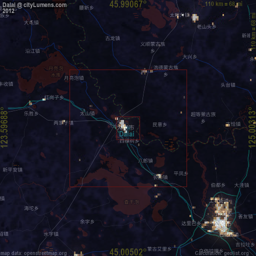
Analysis of Dalai night lights 2016
Square area 10x10 km:
 1.27%
1.27%90-99
5.24%80-89
1.11%70-79
0.16%60-69
2.7%50-59
1.43%40-49
1.27%30-39
1.75%20-29
3.49%10-19
6.35%0-9
75.24%Square area 50x50 km:
0.05%90-99
0.24%80-89
0.04%70-79
0.03%60-69
0.26%50-59
0.18%40-49
0.06%30-39
0.09%20-29
0.26%10-19
0.33%0-9
98.46%Clear (daylight) street map image can be seen on geolist.org.
Map coordinates:
45° 59' 26.4" North, 123° 35' 48.8" East
45° 30' 0" North, 124° 18' 0" East
45° 0' 18.1" North, 125° 0' 11.3" East
Some cities around Dalai sort by population:
• Baicheng
115.8 km =72 mi,  275°
275°
• Honggang
109.9 km =68.3 mi,  24°
24°
• Fuyu
53.6 km =33.3 mi,  131°
131°
• Songyuan
58.3 km =36.2 mi, 134°
• Guangming
119.8 km =74.4 mi,  261°
261°
• Zhenlai
87.1 km =54.1 mi,  296°
296°
• Zhaozhou
81.7 km =50.8 mi,  75°
75°
• Zhaoyuan
64.9 km =40.3 mi,  90°
90°
2037930 (p: 93,297)
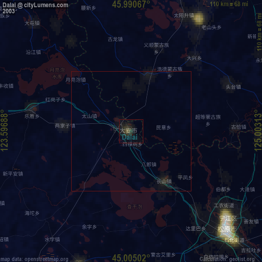
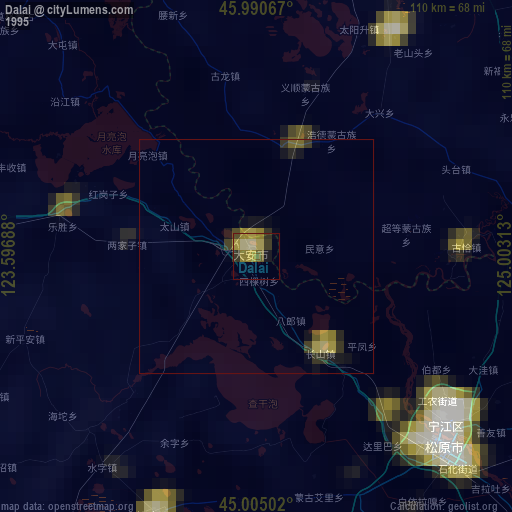
Sources (retrieved 2019-11-25):
» NASA, Earths city lights 1995
» NASA city lights 2003
» Earth at Night: Flat Maps 2012, 2016