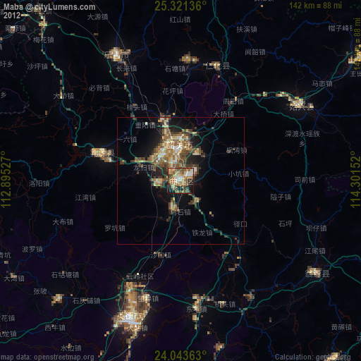
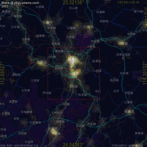
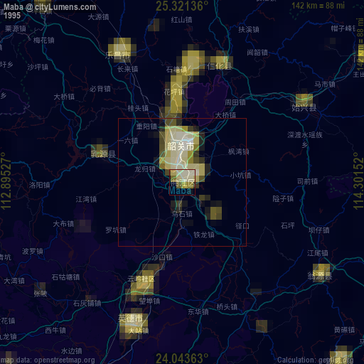
Maba night lights from space
Night Light of Maba (Guangdong) from space (China) Src. Average luminocity for 10x10km area is 41.9206% and for 50x50km: 9.0603%.
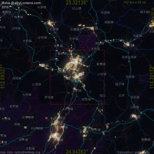
Analysis of Maba night lights 2016
Square area 10x10 km:
 6.15%
6.15%90-99
4.37%80-89
4.76%70-79
3.97%60-69
11.11%50-59
4.17%40-49
7.14%30-39
11.51%20-29
16.87%10-19
24.6%0-9
5.36%Square area 50x50 km:
0.69%90-99
0.95%80-89
1%70-79
1.07%60-69
1.72%50-59
1.62%40-49
1.83%30-39
2.11%20-29
3.15%10-19
6.25%0-9
79.6%Clear (daylight) street map image can be seen on geolist.org.
Map coordinates:
25° 19' 16.9" North, 112° 53' 43" East
24° 41' 2.9" North, 113° 35' 54.2" East
24° 2' 37.1" North, 114° 18' 5.5" East
Some cities around Maba sort by population:
• Shaoguan
13 km =8.1 mi,  353°
353°
• Chenzhou
136.5 km =84.8 mi,  335°
335°
• Qingyuan
123.5 km =76.7 mi,  207°
207°
• Lecheng
55.3 km =34.4 mi,  333°
333°
• Heyuan
152.6 km =94.8 mi,  133°
133°
• Lianzhou
124.4 km =77.3 mi,  275°
275°
• Xiongzhou
85.6 km =53.2 mi,  55°
55°
• Shixing
55.6 km =34.5 mi, 58°
1801615 (p: 113,609)
Sources (retrieved 2019-11-25):
» NASA, Earths city lights 1995
» NASA city lights 2003
» Earth at Night: Flat Maps 2012, 2016