Suining night lights from space
Night Light of Suining (Sichuan) from space (China) Src. Average luminocity for 10x10km area is 69.1758% and for 50x50km: 5.3145%.
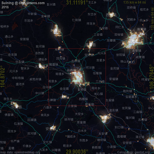
Analysis of Suining night lights 2016
Square area 10x10 km:
 21.06%
90-99
19.96%80-89
5.49%70-79
5.86%60-69
8.42%50-59
5.49%40-49
12.82%30-39
6.96%20-29
10.62%10-19
3.3%0-9
0%Square area 50x50 km:
0.92%90-99
1.03%80-89
0.41%70-79
0.31%60-69
0.59%50-59
0.68%40-49
1.15%30-39
0.61%20-29
1.57%10-19
3.48%0-9
89.26%Clear (daylight) street map image can be seen on geolist.org.
Map coordinates:
31° 6' 42.9" North, 104° 52' 12.7" East
30° 30' 28.9" North, 105° 34' 24" East
29° 54' 1.3" North, 106° 16' 35.2" East
Some cities around Suining sort by population:
• Nanchong
58.4 km =36.3 mi,  56°
56°
• Gaoping
58.8 km =36.5 mi, 59°
• Beibei
112.3 km =69.8 mi,  132°
132°
• Hechuan
87.7 km =54.5 mi, 130°
• Yanjiang
98.7 km =61.3 mi,  244°
244°
• Nanlong
105 km =65.2 mi,  26°
26°
• Chonglong
106.5 km =66.2 mi,  220°
220°
• Tongchuan
80 km =49.7 mi,  324°
324°
1793900 (p: 124,924)
Sources (retrieved 2019-11-25):
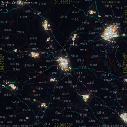
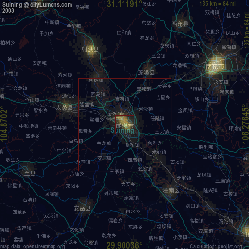
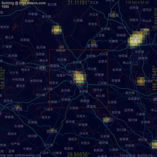
» NASA, Earths city lights 1995
» NASA city lights 2003
» Earth at Night: Flat Maps 2012, 2016