Yongchuan night lights from space
Night Light of Yongchuan (Chongqing) from space (China) Src. Average luminocity for 10x10km area is 47.5208% and for 50x50km: 4.9467%.
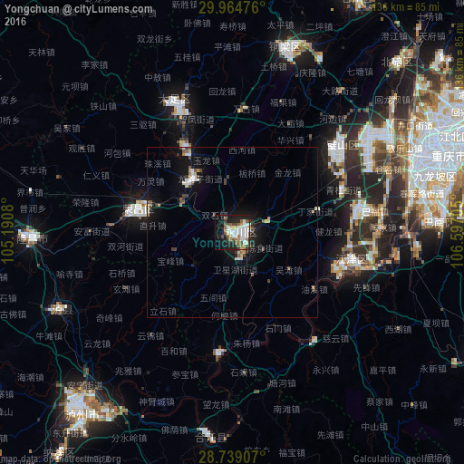
Analysis of Yongchuan night lights 2016
Square area 10x10 km:
 13.26%
90-99
10.98%80-89
4.92%70-79
1.89%60-69
7.39%50-59
5.11%40-49
7.01%30-39
1.52%20-29
10.98%10-19
24.43%0-9
12.5%Square area 50x50 km:
0.79%90-99
0.73%80-89
0.6%70-79
0.26%60-69
0.5%50-59
0.56%40-49
0.94%30-39
0.51%20-29
0.8%10-19
4.9%0-9
89.4%Clear (daylight) street map image can be seen on geolist.org.
Map coordinates:
29° 57' 53.1" North, 105° 11' 26.9" East
29° 21' 13.5" North, 105° 53' 38.1" East
28° 44' 20.7" North, 106° 35' 49.4" East
Some cities around Yongchuan sort by population:
• Chongqing
67.9 km =42.2 mi,  69°
69°
• Neijiang
84.5 km =52.5 mi,  287°
287°
• Beibei
74.3 km =46.2 mi,  44°
44°
• Hechuan
79.5 km =49.4 mi,  26°
26°
• Yudong
60.7 km =37.7 mi,  86°
86°
• Jijiang
35.2 km =21.9 mi,  101°
101°
• Dongxi
99.5 km =61.8 mi,  131°
131°
• Ganshui
104.6 km =65 mi, 130°
1786378 (p: 94,465)
Sources (retrieved 2019-11-25):
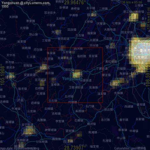
» NASA, Earths city lights 1995
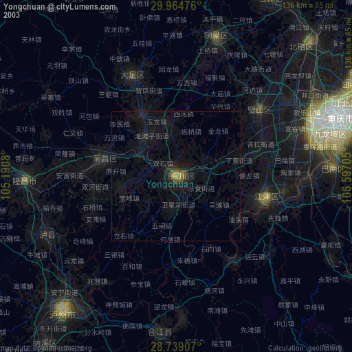
» NASA city lights 2003
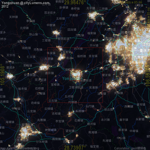
» Earth at Night: Flat Maps 2012, 2016