Viña del Mar night lights from space
Night Light of Viña del Mar (Valparaíso) from space (Chile) Src. Average luminocity for 10x10km area is 73.7527% and for 50x50km: 12.8712%.
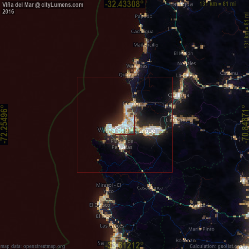
Analysis of Viña del Mar night lights 2016
Square area 10x10 km:
 21.43%
90-99
27.29%80-89
6.23%70-79
9.89%60-69
5.31%50-59
4.76%40-49
1.47%30-39
12.45%20-29
8.61%10-19
2.56%0-9
0%Square area 50x50 km:
2.15%90-99
2.65%80-89
1.69%70-79
1.4%60-69
1.19%50-59
1.14%40-49
0.96%30-39
1.83%20-29
4.67%10-19
9.75%0-9
72.57%Clear (daylight) street map image can be seen on geolist.org.
Map coordinates:
32° 25' 59.1" South, 72° 15' 17.9" West
33° 1' 28.5" South, 71° 33' 6.6" West
33° 36' 43.6" South, 70° 50' 55.4" West
Some cities around Viña del Mar sort by population:
• Valparaíso
7.4 km =4.6 mi,  260°
260°
• Quilpué
10.5 km =6.5 mi,  104°
104°
• Villa Alemana
16.8 km =10.4 mi, 96°
• Quillota
32.3 km =20.1 mi,  60°
60°
• Hacienda La Calera
41.2 km =25.6 mi,  49°
49°
• Limache
26.6 km =16.5 mi,  88°
88°
• Cartagena
59.1 km =36.7 mi,  185°
185°
• Llaillay
59.2 km =36.8 mi,  69°
69°
3868121 (p: 294,551)
Sources (retrieved 2019-11-25):
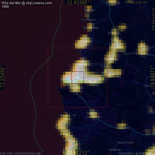
» NASA, Earths city lights 1995
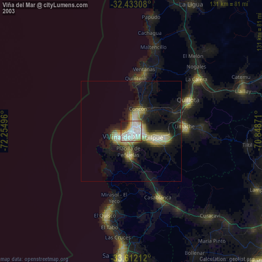
» NASA city lights 2003
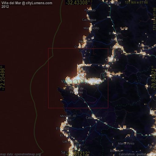
» Earth at Night: Flat Maps 2012, 2016