Cartagena night lights from space
Night Light of Cartagena (Valparaíso) from space (Chile) Src. Average luminocity for 10x10km area is 38.4451% and for 50x50km: 6.1569%.
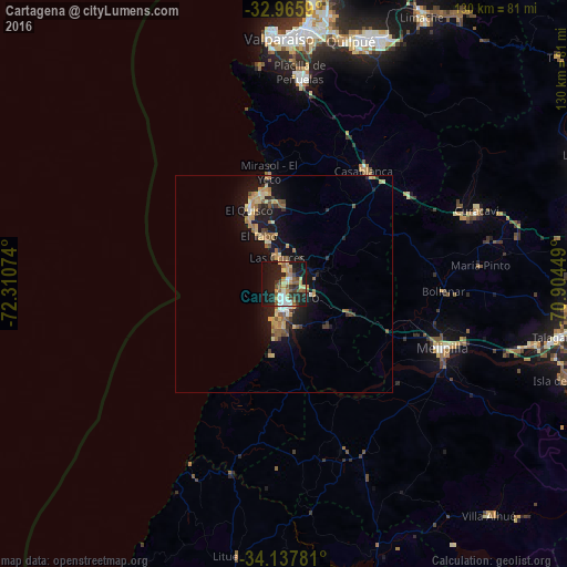
Analysis of Cartagena night lights 2016
Square area 10x10 km:
 2.56%
2.56%90-99
6.23%80-89
7.14%70-79
4.21%60-69
6.41%50-59
7.51%40-49
4.95%30-39
4.76%20-29
12.82%10-19
35.71%0-9
7.69%Square area 50x50 km:
0.27%90-99
0.49%80-89
1.14%70-79
1.1%60-69
0.99%50-59
1.15%40-49
0.54%30-39
0.88%20-29
1.35%10-19
6.61%0-9
85.47%Clear (daylight) street map image can be seen on geolist.org.
Map coordinates:
32° 57' 57.2" South, 72° 18' 38.7" West
33° 33' 13.8" South, 71° 36' 27.4" West
34° 8' 16.1" South, 70° 54' 16.2" West
Some cities around Cartagena sort by population:
• Viña del Mar
59.1 km =36.7 mi,  5°
5°
• Valparaíso
57.6 km =35.8 mi,  357°
357°
• Quilpué
58.4 km =36.3 mi,  15°
15°
• Villa Alemana
60.9 km =37.8 mi, 20°
• San Antonio
4.5 km =2.8 mi,  179°
179°
• Melipilla
39.3 km =24.4 mi,  112°
112°
• Talagante
64.2 km =39.9 mi,  100°
100°
• El Monte
59.3 km =36.8 mi, 103°
3896433 (p: 16,875)
Sources (retrieved 2019-11-25):
» Earth at Night: Flat Maps 2012, 2016