Santa Cruz night lights from space
Night Light of Santa Cruz (O'Higgins Region) from space (Chile) Src. Average luminocity for 10x10km area is 14.1014% and for 50x50km: 2.238%.
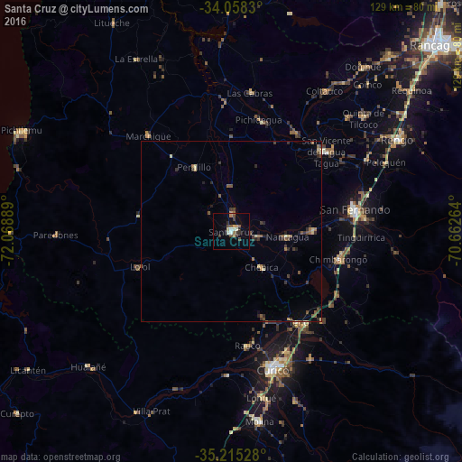
Analysis of Santa Cruz night lights 2016
Square area 10x10 km:
 0.87%
0.87%90-99
2.62%80-89
1.22%70-79
1.92%60-69
1.57%50-59
1.57%40-49
3.5%30-39
2.8%20-29
1.4%10-19
1.22%0-9
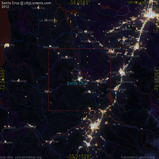
81.29%Square area 50x50 km:
0.04%90-99
0.2%80-89
0.31%70-79
0.15%60-69
0.37%50-59
0.48%40-49
0.4%30-39
0.65%20-29
0.55%10-19
0.46%0-9
96.38%Clear (daylight) street map image can be seen on geolist.org.
Map coordinates:
34° 3' 29.9" South, 72° 4' 8" West
34° 38' 19.7" South, 71° 21' 56.7" West
35° 12' 55" South, 70° 39' 45.5" West
Some cities around Santa Cruz sort by population:
• Curicó
39.9 km =24.8 mi,  163°
163°
• Rengo
53.2 km =33.1 mi,  60°
60°
• San Vicente de Tagua Tagua
34.5 km =21.4 mi,  49°
49°
• Molina
53.4 km =33.2 mi,  171°
171°
• San Vicente
34.5 km =21.4 mi, 48°
• Chimbarongo
30.6 km =19 mi,  105°
105°
• Rauco
32.2 km =20 mi, 172°
• Teno
31.8 km =19.8 mi,  144°
144°
3871616 (p: 33,283)
Sources (retrieved 2019-11-25):
» Earth at Night: Flat Maps 2012, 2016