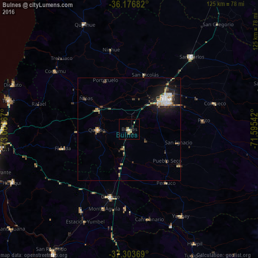
Bulnes night lights from space
Night Light of Bulnes (Ñuble) from space (Chile) Src. Average luminocity for 10x10km area is 8.5035% and for 50x50km: 4.6307%.
Analysis of Bulnes night lights 2016
Square area 10x10 km:
100  0%
0%
90-99 0.7%
80-89 2.8%
70-79 0.7%
60-69 2.1%
50-59 0.87%
40-49 1.22%
30-39 0.87%
20-29 2.27%
10-19 0%
0-9 88.46%
0%90-99
0.7%80-89
2.8%70-79
0.7%60-69
2.1%50-59
0.87%40-49
1.22%30-39
0.87%20-29
2.27%10-19
0%0-9
88.46%Square area 50x50 km:
100 0.53%
90-99 0.61%
80-89 0.77%
70-79 0.53%
60-69 0.66%
50-59 0.4%
40-49 0.75%
30-39 0.57%
20-29 1.45%
10-19 2.92%
0-9 90.8%
0.53%90-99
0.61%80-89
0.77%70-79
0.53%60-69
0.66%50-59
0.4%40-49
0.75%30-39
0.57%20-29
1.45%10-19
2.92%0-9
90.8%Clear (daylight) street map image can be seen on geolist.org.
Map coordinates:
36° 10' 36.6" South, 73° 0' 6" West
36° 44' 32.4" South, 72° 17' 54.7" West
37° 18' 13.3" South, 71° 35' 43.5" West
Some cities around Bulnes sort by population:
• Chillán
23 km =14.3 mi,  49°
49°
• Tomé
60.2 km =37.4 mi,  283°
283°
• Penco
62.1 km =38.6 mi,  270°
270°
• San Carlos
46.6 km =29 mi,  40°
40°
• Cabrero
33.8 km =21 mi,  196°
196°
• Yumbel
45.9 km =28.5 mi,  210°
210°
• Quirihue
55.8 km =34.7 mi,  337°
337°
• Coihueco
43.6 km =27.1 mi,  73°
73°
3897724 (p: 12,715)
Sources (retrieved 2019-11-25):
» Earth at Night: Flat Maps 2012, 2016