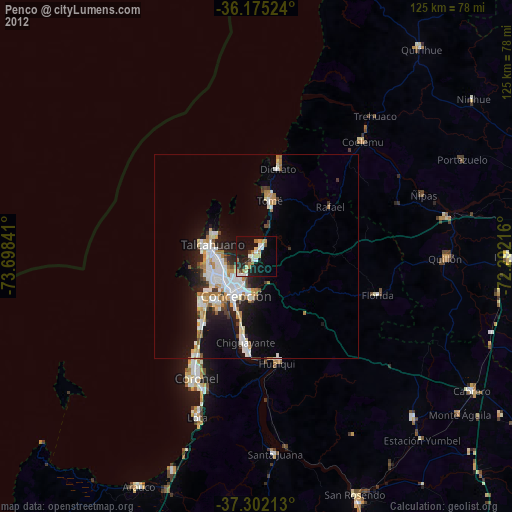
Penco night lights from space
Night Light of Penco (Biobío) from space (Chile) Src. Average luminocity for 10x10km area is 29.0927% and for 50x50km: 11.8629%.

Analysis of Penco night lights 2016
Square area 10x10 km:
 3.67%
3.67%90-99
3.67%80-89
4.37%70-79
4.55%60-69
3.85%50-59
1.75%40-49
1.05%30-39
4.72%20-29
12.76%10-19
32.34%0-9
27.27%Square area 50x50 km:
2.49%90-99
2.07%80-89
1.42%70-79
1.32%60-69
1.55%50-59
0.89%40-49
0.95%30-39
1.49%20-29
3.27%10-19
8.42%0-9
76.12%Clear (daylight) street map image can be seen on geolist.org.
Map coordinates:
36° 10' 30.9" South, 73° 41' 54.3" West
36° 44' 26.7" South, 72° 59' 43" West
37° 18' 7.7" South, 72° 17' 31.8" West
Some cities around Penco sort by population:
• Talcahuano
11 km =6.8 mi,  279°
279°
• Concepción
10.7 km =6.6 mi,  206°
206°
• Coronel
35 km =21.7 mi,  201°
201°
• Chiguayante
20.8 km =12.9 mi,  188°
188°
• Lota
41.4 km =25.7 mi, 200°
• Tomé
14.1 km =8.8 mi,  14°
14°
• Cabrero
61.8 km =38.4 mi,  121°
121°
• Yumbel
55.4 km =34.4 mi,  135°
135°
3876664 (p: 46,091)
Sources (retrieved 2019-11-25):
» Earth at Night: Flat Maps 2012, 2016