Schwyz night lights from space
Night Light of Schwyz from space (Switzerland) Src. Average luminocity for 10x10km area is 6.6619% and for 50x50km: 4.9888%.
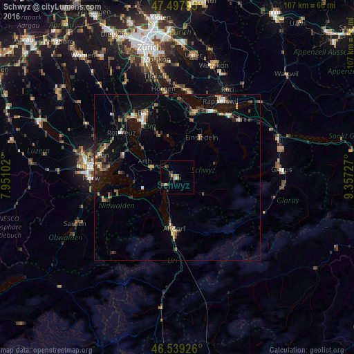
Analysis of Schwyz night lights 2016
Square area 10x10 km:
 0.14%
0.14%90-99
0.43%80-89
0.57%70-79
0.57%60-69
1.7%50-59
1.7%40-49
2.13%30-39
1.42%20-29
2.13%10-19
1.14%0-9
88.07%Square area 50x50 km:
0.25%90-99
0.4%80-89
0.42%70-79
0.76%60-69
0.71%50-59
0.77%40-49
1%30-39
0.96%20-29
1.23%10-19
3.46%0-9
90.03%Clear (daylight) street map image can be seen on geolist.org.
Map coordinates:
47° 29' 52.6" North, 7° 57' 3.7" East
47° 1' 14.7" North, 8° 39' 14.9" East
46° 32' 21.3" North, 9° 21' 26.2" East
Some cities around Schwyz sort by population:
• Einsiedeln
13.9 km =8.6 mi,  30°
30°
• Küssnacht
17.6 km =10.9 mi,  294°
294°
• Arth
11 km =6.8 mi,  295°
295°
• Altdorf
15.6 km =9.7 mi,  182°
182°
• Unterägeri
13.9 km =8.6 mi,  337°
337°
• Ingenbohl
3.8 km =2.4 mi,  230°
230°
• Buochs
18.3 km =11.4 mi,  253°
253°
• Goldau
8.7 km =5.4 mi, 290°
2658665 (p: 14,177)
Sources (retrieved 2019-11-25):
» Earth at Night: Flat Maps 2012, 2016