Arth night lights from space
Night Light of Arth (Schwyz) from space (Switzerland) Src. Average luminocity for 10x10km area is 2.7699% and for 50x50km: 7.5397%.
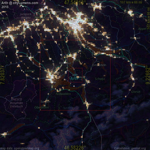
Analysis of Arth night lights 2016
Square area 10x10 km:
100  0%
0%
90-99 0%
80-89 0%
70-79 0%
60-69 1.7%
50-59 0%
40-49 0.71%
30-39 0.99%
20-29 0.28%
10-19 0.57%
0-9 95.74%
0%90-99
0%80-89
0%70-79
0%60-69
1.7%50-59
0%40-49
0.71%30-39
0.99%20-29
0.28%10-19
0.57%0-9
95.74%Square area 50x50 km:
100 0.47%
90-99 0.7%
80-89 0.67%
70-79 0.91%
60-69 1.31%
50-59 1.24%
40-49 1.41%
30-39 1.31%
20-29 1.8%
10-19 5.29%
0-9 84.89%
0.47%90-99
0.7%80-89
0.67%70-79
0.91%60-69
1.31%50-59
1.24%40-49
1.41%30-39
1.31%20-29
1.8%10-19
5.29%0-9
84.89%Clear (daylight) street map image can be seen on geolist.org.
Map coordinates:
47° 32' 24.6" North, 7° 49' 13.3" East
47° 3' 48.1" North, 8° 31' 24.6" East
46° 34' 56.1" North, 9° 13' 35.8" East
Some cities around Arth sort by population:
• Zug
12.1 km =7.5 mi,  357°
357°
• Schwyz
11 km =6.8 mi,  115°
115°
• Küssnacht
6.6 km =4.1 mi,  291°
291°
• Rotkreuz
11.3 km =7 mi,  321°
321°
• Unterägeri
9.4 km =5.8 mi,  29°
29°
• Ingenbohl
10 km =6.2 mi,  135°
135°
• Meggen
11.4 km =7.1 mi,  260°
260°
• Goldau
2.5 km =1.6 mi, 135°
2661708 (p: 9,850)
Sources (retrieved 2019-11-25):
» Earth at Night: Flat Maps 2012, 2016