Ingenbohl night lights from space
Night Light of Ingenbohl (Schwyz) from space (Switzerland) Src. Average luminocity for 10x10km area is 6.3423% and for 50x50km: 5.349%.
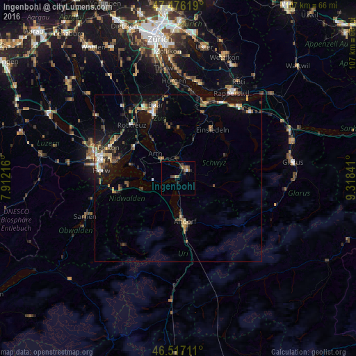
Analysis of Ingenbohl night lights 2016
Square area 10x10 km:
 0.14%
0.14%90-99
0.43%80-89
0.57%70-79
0.57%60-69
1.7%50-59
1.7%40-49
1.56%30-39
0.99%20-29
2.13%10-19
1.7%0-9
88.49%Square area 50x50 km:
0.36%90-99
0.62%80-89
0.45%70-79
0.74%60-69
0.8%50-59
0.87%40-49
0.97%30-39
0.94%20-29
1.38%10-19
3.72%0-9
89.15%Clear (daylight) street map image can be seen on geolist.org.
Map coordinates:
47° 28' 34.3" North, 7° 54' 43.8" East
46° 59' 55.7" North, 8° 36' 55" East
46° 31' 1.6" North, 9° 19' 6.3" East
Some cities around Ingenbohl sort by population:
• Schwyz
3.8 km =2.4 mi,  50°
50°
• Einsiedeln
17.5 km =10.9 mi,  34°
34°
• Küssnacht
16.3 km =10.1 mi,  306°
306°
• Arth
10 km =6.2 mi,  315°
315°
• Altdorf
13.3 km =8.3 mi,  170°
170°
• Unterägeri
15.5 km =9.6 mi,  351°
351°
• Buochs
14.9 km =9.3 mi,  259°
259°
• Goldau
7.5 km =4.7 mi, 316°
2660261 (p: 7,967)
Sources (retrieved 2019-11-25):
» Earth at Night: Flat Maps 2012, 2016