Höchst night lights from space
Night Light of Höchst (Vorarlberg) from space (Austria) Src. Average luminocity for 10x10km area is 27.0426% and for 50x50km: 8.2715%.
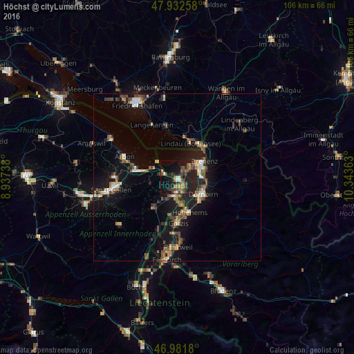
Analysis of Höchst night lights 2016
Square area 10x10 km:
 0.43%
0.43%90-99
2.7%80-89
1.7%70-79
3.41%60-69
4.55%50-59
6.11%40-49
8.24%30-39
5.68%20-29
14.2%10-19
25.99%0-9
26.99%Square area 50x50 km:
0.55%90-99
1.01%80-89
0.68%70-79
0.87%60-69
1.33%50-59
1.42%40-49
1.72%30-39
1.26%20-29
2.11%10-19
8.73%0-9
80.33%Clear (daylight) street map image can be seen on geolist.org.
Map coordinates:
47° 55' 57.3" North, 8° 56' 14.6" East
47° 27' 33.6" North, 9° 38' 25.8" East
46° 58' 54.5" North, 10° 20' 37.1" East
Some cities around Höchst sort by population:
• Lustenau
3.9 km =2.4 mi,  159°
159°
• Hard
4.1 km =2.5 mi,  50°
50°
• Lauterach
6.9 km =4.3 mi,  74°
74°
• Wolfurt
8.3 km =5.2 mi,  84°
84°
• Au, CH
3.2 km =2 mi,  188°
188°
• Thal, CH
5.6 km =3.5 mi,  278°
278°
• Diepoldsau, CH
8.2 km =5.1 mi,  172°
172°
• Sankt Margrethen, CH
0.8 km =0.5 mi,  197°
197°
2775950 (p: 7,995)
Sources (retrieved 2019-11-25):
» Earth at Night: Flat Maps 2012, 2016