Bagnes night lights from space
Night Light of Bagnes (Valais) from space (Switzerland) Src. Average luminocity for 10x10km area is 7.1577% and for 50x50km: 5.3762%.
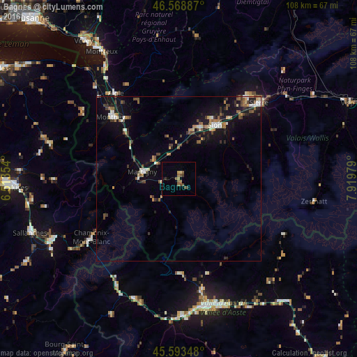
Analysis of Bagnes night lights 2016
Square area 10x10 km:
 0%
0%90-99
0.14%80-89
0.85%70-79
0.57%60-69
1.28%50-59
3.55%40-49
1.85%30-39
1.14%20-29
0%10-19
0.99%0-9
89.63%Square area 50x50 km:
0.41%90-99
0.77%80-89
0.46%70-79
0.53%60-69
0.69%50-59
0.97%40-49
0.93%30-39
0.9%20-29
0.93%10-19
4.82%0-9
88.58%Clear (daylight) street map image can be seen on geolist.org.
Map coordinates:
46° 34' 7.9" North, 6° 30' 48.7" East
46° 4' 60" North, 7° 13' 0" East
45° 35' 36.5" North, 7° 55' 11.2" East
Some cities around Bagnes sort by population:
• Sitten
19.3 km =12 mi,  33°
33°
• Monthey
27.8 km =17.3 mi,  313°
313°
• Martigny-Ville
11.3 km =7 mi,  280°
280°
• Conthey
17 km =10.6 mi,  23°
23°
• Bex
24.4 km =15.2 mi,  319°
319°
• Fully
10 km =6.2 mi, 307°
• Savièse
21.1 km =13.1 mi, 28°
• Basse-Nendaz
13.9 km =8.6 mi, 31°
2661641 (p: 6,626)
Sources (retrieved 2019-11-25):
» Earth at Night: Flat Maps 2012, 2016