Herzogenbuchsee night lights from space
Night Light of Herzogenbuchsee (Bern) from space (Switzerland) Src. Average luminocity for 10x10km area is 9.8839% and for 50x50km: 11.3402%.
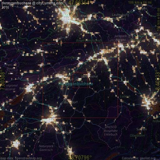
Analysis of Herzogenbuchsee night lights 2016
Square area 10x10 km:
 0.45%
0.45%90-99
0.45%80-89
0.6%70-79
1.93%60-69
0.89%50-59
2.53%40-49
0.15%30-39
2.08%20-29
1.93%10-19
3.27%0-9
85.71%Square area 50x50 km:
0.87%90-99
1.49%80-89
0.89%70-79
1.12%60-69
1.68%50-59
1.71%40-49
1.83%30-39
2.02%20-29
3.42%10-19
10.91%0-9
74.07%Clear (daylight) street map image can be seen on geolist.org.
Map coordinates:
47° 39' 49.1" North, 7° 0' 11.1" East
47° 11' 16.6" North, 7° 42' 22.3" East
46° 42' 28.7" North, 8° 24' 33.6" East
Some cities around Herzogenbuchsee sort by population:
• Solothurn
13 km =8.1 mi,  279°
279°
• Burgdorf
15.5 km =9.6 mi,  202°
202°
• Langenthal
7.4 km =4.6 mi,  65°
65°
• Zuchwil
10.7 km =6.6 mi, 278°
• Biberist
10.9 km =6.8 mi,  265°
265°
• Derendingen
9 km =5.6 mi, 277°
• Balsthal
14.3 km =8.9 mi,  356°
356°
• Kirchberg
14.7 km =9.1 mi,  219°
219°
2660355 (p: 5,522)
Sources (retrieved 2019-11-25):
» Earth at Night: Flat Maps 2012, 2016