Biberist night lights from space
Night Light of Biberist (Solothurn) from space (Switzerland) Src. Average luminocity for 10x10km area is 36.686% and for 50x50km: 12.0632%.
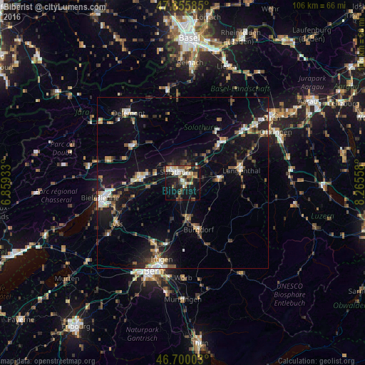
Analysis of Biberist night lights 2016
Square area 10x10 km:
 5.06%
5.06%90-99
6.99%80-89
4.76%70-79
4.46%60-69
5.51%50-59
5.06%40-49
4.91%30-39
4.17%20-29
6.4%10-19
35.42%0-9
17.26%Square area 50x50 km:
1.13%90-99
1.75%80-89
1%70-79
1.07%60-69
1.53%50-59
1.58%40-49
1.9%30-39
2.16%20-29
3.06%10-19
11.62%0-9
73.19%Clear (daylight) street map image can be seen on geolist.org.
Map coordinates:
47° 39' 21.1" North, 6° 51' 33.6" East
47° 10' 48.3" North, 7° 33' 44.9" East
46° 42' 0.1" North, 8° 15' 56.1" East
Some cities around Biberist sort by population:
• Grenchen
12.7 km =7.9 mi,  276°
276°
• Solothurn
3.6 km =2.2 mi,  328°
328°
• Burgdorf
14.3 km =8.9 mi,  159°
159°
• Zuchwil
2.4 km =1.5 mi,  7°
7°
• Lengnau
14.7 km =9.1 mi,  270°
270°
• Derendingen
2.8 km =1.7 mi,  43°
43°
• Herzogenbuchsee
10.9 km =6.8 mi,  85°
85°
• Kirchberg
10.6 km =6.6 mi,  171°
171°
2661519 (p: 7,889)
Sources (retrieved 2019-11-25):
» Earth at Night: Flat Maps 2012, 2016