Solothurn night lights from space
Night Light of Solothurn from space (Switzerland) Src. Average luminocity for 10x10km area is 36.5045% and for 50x50km: 11.5665%.
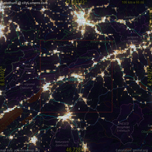
Analysis of Solothurn night lights 2016
Square area 10x10 km:
 5.06%
5.06%90-99
6.99%80-89
4.76%70-79
3.72%60-69
4.32%50-59
4.32%40-49
5.36%30-39
6.99%20-29
10.12%10-19
33.93%0-9
14.43%Square area 50x50 km:
1%90-99
1.54%80-89
0.99%70-79
1.09%60-69
1.43%50-59
1.51%40-49
1.83%30-39
2.18%20-29
2.65%10-19
11.38%0-9
74.4%Clear (daylight) street map image can be seen on geolist.org.
Map coordinates:
47° 41' 0.3" North, 6° 50' 2.5" East
47° 12' 28.5" North, 7° 32' 13.7" East
46° 43' 41.2" North, 8° 14' 25" East
Some cities around Solothurn sort by population:
• Grenchen
10.8 km =6.7 mi,  260°
260°
• Zuchwil
2.3 km =1.4 mi,  107°
107°
• Biberist
3.6 km =2.2 mi,  148°
148°
• Moutier
14.9 km =9.3 mi,  301°
301°
• Lengnau
13.1 km =8.1 mi, 257°
• Derendingen
4 km =2.5 mi, 105°
• Herzogenbuchsee
13 km =8.1 mi,  99°
99°
• Kirchberg
14.1 km =8.8 mi,  165°
165°
2658564 (p: 14,853)
Sources (retrieved 2019-11-25):
» Earth at Night: Flat Maps 2012, 2016