Kirchberg night lights from space
Night Light of Kirchberg (Bern) from space (Switzerland) Src. Average luminocity for 10x10km area is 12.3438% and for 50x50km: 11.7538%.
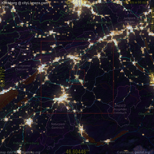
Analysis of Kirchberg night lights 2016
Square area 10x10 km:
 0.43%
0.43%90-99
0.14%80-89
1.14%70-79
0.57%60-69
3.41%50-59
2.56%40-49
2.27%30-39
4.69%20-29
1.14%10-19
3.41%0-9
80.26%Square area 50x50 km:
1.11%90-99
1.66%80-89
1.11%70-79
1.07%60-69
1.44%50-59
1.62%40-49
2.02%30-39
2.01%20-29
3.07%10-19
11.51%0-9
73.39%Clear (daylight) street map image can be seen on geolist.org.
Map coordinates:
47° 33' 43.2" North, 6° 52' 47.1" East
47° 5' 7.4" North, 7° 34' 58.4" East
46° 36' 16.1" North, 8° 17' 9.6" East
Some cities around Kirchberg sort by population:
• Burgdorf
4.5 km =2.8 mi,  130°
130°
• Münchenbuchsee
12.3 km =7.6 mi,  234°
234°
• Zuchwil
13 km =8.1 mi,  354°
354°
• Zollikofen
13.5 km =8.4 mi,  224°
224°
• Biberist
10.6 km =6.6 mi, 351°
• Derendingen
12.6 km =7.8 mi,  1°
1°
• Urtenen
9 km =5.6 mi, 223°
• Sumiswald
13.9 km =8.6 mi,  117°
117°
2660156 (p: 5,335)
Sources (retrieved 2019-11-25):
» Earth at Night: Flat Maps 2012, 2016