Binningen night lights from space
Night Light of Binningen (Basel-Landschaft) from space (Switzerland) Src. Average luminocity for 10x10km area is 66.7415% and for 50x50km: 17.1618%.
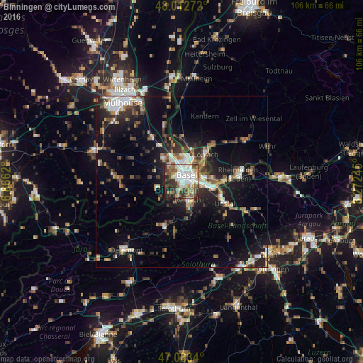
Analysis of Binningen night lights 2016
Square area 10x10 km:
 18.75%
90-99
18.61%80-89
5.68%70-79
6.39%60-69
6.96%50-59
9.66%40-49
8.1%30-39
11.08%20-29
10.23%10-19
4.4%0-9
0.14%Square area 50x50 km:
2.74%90-99
2.8%80-89
1.27%70-79
1.65%60-69
1.97%50-59
2.59%40-49
2.51%30-39
3.14%20-29
5.1%10-19
11.98%0-9
64.25%Clear (daylight) street map image can be seen on geolist.org.
Map coordinates:
48° 0' 45.8" North, 6° 51' 58.3" East
47° 32' 24.8" North, 7° 34' 9.6" East
47° 3' 48.2" North, 8° 16' 20.8" East
Some cities around Binningen sort by population:
• Basel
2 km =1.2 mi,  8°
8°
• Saint-Louis, FR
5.8 km =3.6 mi,  352°
352°
• Allschwil
2.8 km =1.7 mi,  295°
295°
• Münchenstein
3.9 km =2.4 mi,  128°
128°
• Birsfelden
4.3 km =2.7 mi,  70°
70°
• Oberwil
3 km =1.9 mi,  196°
196°
• Therwil
4.6 km =2.9 mi,  191°
191°
• Bottmingen
1.9 km =1.2 mi,  173°
173°
2661499 (p: 14,130)
Sources (retrieved 2019-11-25):
» Earth at Night: Flat Maps 2012, 2016