Münchenstein night lights from space
Night Light of Münchenstein (Basel-Landschaft) from space (Switzerland) Src. Average luminocity for 10x10km area is 62.0952% and for 50x50km: 16.6614%.
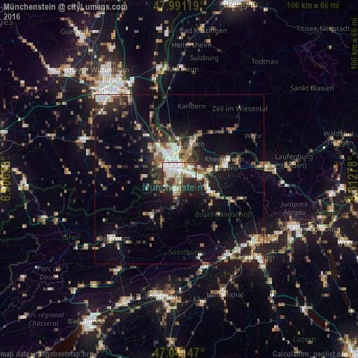
Analysis of Münchenstein night lights 2016
Square area 10x10 km:
 16.19%
90-99
17.05%80-89
6.53%70-79
6.96%60-69
4.97%50-59
8.66%40-49
4.55%30-39
10.51%20-29
14.35%10-19
10.09%0-9
0.14%Square area 50x50 km:
2.31%90-99
2.69%80-89
1.23%70-79
1.68%60-69
2.09%50-59
2.52%40-49
2.57%30-39
3.21%20-29
5.02%10-19
11.37%0-9
65.31%Clear (daylight) street map image can be seen on geolist.org.
Map coordinates:
47° 59' 28.3" North, 6° 54' 23.5" East
47° 31' 6.5" North, 7° 36' 34.8" East
47° 2' 29.3" North, 8° 18' 46" East
Some cities around Münchenstein sort by population:
• Muttenz
2.7 km =1.7 mi,  79°
79°
• Binningen
3.9 km =2.4 mi,  308°
308°
• Birsfelden
4 km =2.5 mi,  14°
14°
• Oberwil
3.9 km =2.4 mi,  262°
262°
• Therwil
4.5 km =2.8 mi,  241°
241°
• Arlesheim
2.8 km =1.7 mi,  164°
164°
• Dornach
4.3 km =2.7 mi,  173°
173°
• Bottmingen
2.9 km =1.8 mi,  281°
281°
2659551 (p: 11,644)
Sources (retrieved 2019-11-25):
» Earth at Night: Flat Maps 2012, 2016