Rotkreuz night lights from space
Night Light of Rotkreuz (Zug) from space (Switzerland) Src. Average luminocity for 10x10km area is 13.6236% and for 50x50km: 11.1007%.
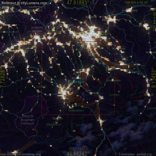
Analysis of Rotkreuz night lights 2016
Square area 10x10 km:
100  0.43%
0.43%
90-99 0.71%
80-89 1.28%
70-79 3.55%
60-69 0.57%
50-59 2.7%
40-49 2.84%
30-39 0.99%
20-29 1.99%
10-19 12.78%
0-9 72.16%
0.43%90-99
0.71%80-89
1.28%70-79
3.55%60-69
0.57%50-59
2.7%40-49
2.84%30-39
0.99%20-29
1.99%10-19
12.78%0-9
72.16%Square area 50x50 km:
100 0.76%
90-99 1.22%
80-89 0.74%
70-79 1.14%
60-69 2.16%
50-59 1.76%
40-49 2.23%
30-39 2.13%
20-29 2.98%
10-19 8.67%
0-9 76.21%
0.76%90-99
1.22%80-89
0.74%70-79
1.14%60-69
2.16%50-59
1.76%40-49
2.23%30-39
2.13%20-29
2.98%10-19
8.67%0-9
76.21%Clear (daylight) street map image can be seen on geolist.org.
Map coordinates:
47° 37' 8.1" North, 7° 43' 41.8" East
47° 8' 34.2" North, 8° 25' 53" East
46° 39' 44.7" North, 9° 8' 4.3" East
Some cities around Rotkreuz sort by population:
• Zug
7.3 km =4.5 mi,  63°
63°
• Baar
9.5 km =5.9 mi,  51°
51°
• Cham
5 km =3.1 mi,  29°
29°
• Küssnacht
6.4 km =4 mi,  172°
172°
• Ebikon
9.9 km =6.2 mi,  224°
224°
• Hünenberg
3.6 km =2.2 mi,  352°
352°
• Steinhausen
7.1 km =4.4 mi,  35°
35°
• Buchrain
8.2 km =5.1 mi,  230°
230°
2658950 (p: 10,439)
Sources (retrieved 2019-11-25):
» Earth at Night: Flat Maps 2012, 2016