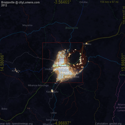
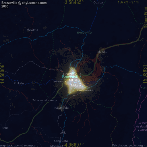
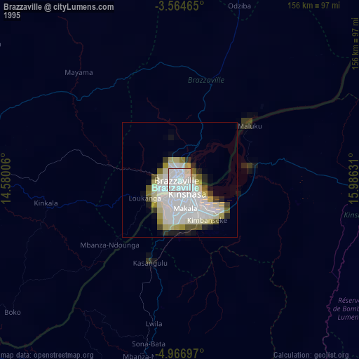
Brazzaville night lights from space
Night Light of Brazzaville from space (Republic of the Congo) Src. Average luminocity for 10x10km area is 87.0303% and for 50x50km: 27.0177%.

Analysis of Brazzaville night lights 2016
Square area 10x10 km:
 28.35%
90-99
30.74%80-89
11.26%70-79
12.12%60-69
7.36%50-59
8.87%40-49
1.3%30-39
0%20-29
0%10-19
0%0-9
0%Square area 50x50 km:
6.29%90-99
5.09%80-89
2.4%70-79
4.15%60-69
4.24%50-59
5.37%40-49
2.71%30-39
2.1%20-29
4.02%10-19
8.9%0-9
54.72%Clear (daylight) street map image can be seen on geolist.org.
Map coordinates:
3° 33' 52.7" South, 14° 34' 48.2" East
4° 15' 58.1" South, 15° 16' 59.4" East
4° 58' 1.1" South, 15° 59' 10.7" East
Some cities around Brazzaville sort by population:
• Kinshasa, CD
7.6 km =4.7 mi,  153°
153°
• Masina, CD
17.7 km =11 mi,  137°
137°
• Mbanza-Ngungu, CD
119.9 km =74.5 mi,  203°
203°
• Kayes
221.6 km =137.7 mi,  271°
271°
• Kasangulu, CD
37.6 km =23.4 mi, 200°
• Madingou
192.6 km =119.7 mi, 273°
• Kinkala
58.5 km =36.4 mi,  259°
259°
• Djambala
200.2 km =124.4 mi,  342°
342°
2260535 (p: 1,284,609)
Sources (retrieved 2019-11-25):
» NASA, Earths city lights 1995
» NASA city lights 2003
» Earth at Night: Flat Maps 2012, 2016