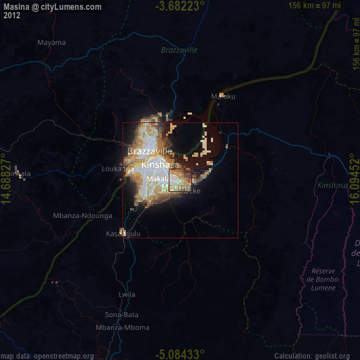
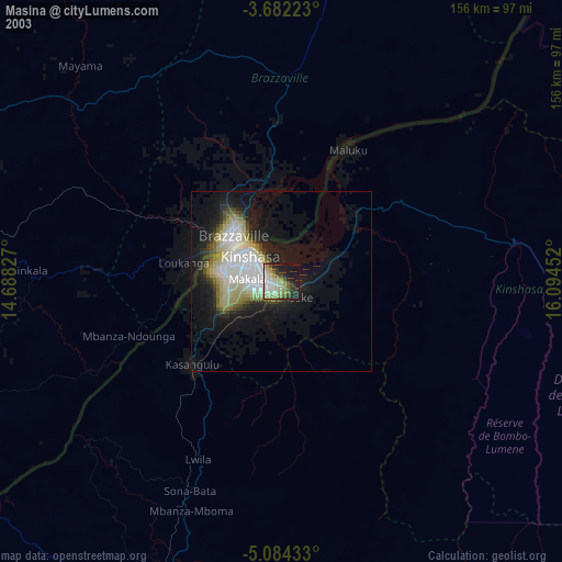
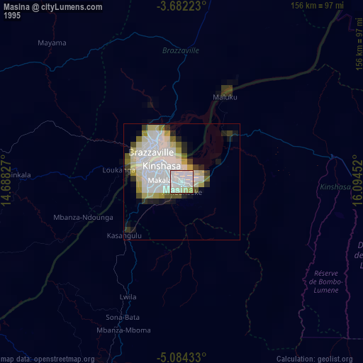
Masina night lights from space
Night Light of Masina (Kinshasa) from space (Democratic Republic of the Congo) Src. Average luminocity for 10x10km area is 68.4004% and for 50x50km: 25.3761%.
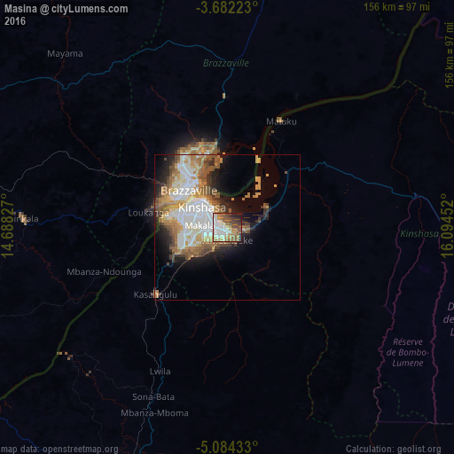
Analysis of Masina night lights 2016
Square area 10x10 km:
 20.35%
90-99
12.77%80-89
3.9%70-79
10.61%60-69
11.47%50-59
15.37%40-49
10.61%30-39
4.98%20-29
6.28%10-19
3.68%0-9
0%Square area 50x50 km:
6.22%90-99
5.02%80-89
2.23%70-79
3.97%60-69
3.83%50-59
4.67%40-49
2.59%30-39
1.98%20-29
3.65%10-19
6.79%0-9
59.05%Clear (daylight) street map image can be seen on geolist.org.
Map coordinates:
3° 40' 56" South, 14° 41' 17.8" East
4° 23' 1" South, 15° 23' 29" East
5° 5' 3.6" South, 16° 5' 40.3" East
Some cities around Masina sort by population:
• Kinshasa
10.6 km =6.6 mi,  305°
305°
• Brazzaville, CG
17.7 km =11 mi,  317°
317°
• Mbanza-Ngungu
113.8 km =70.7 mi,  211°
211°
• Mushie
227.9 km =141.6 mi,  48°
48°
• Kasangulu
33.5 km =20.8 mi,  228°
228°
• Madingou, CG
205.8 km =127.9 mi,  277°
277°
• Kinkala, CG
69.6 km =43.2 mi,  272°
272°
• Djambala, CG
216.4 km =134.5 mi,  340°
340°
2593460 (p: 485,167)
Sources (retrieved 2019-11-25):
» NASA, Earths city lights 1995
» NASA city lights 2003
» Earth at Night: Flat Maps 2012, 2016