Winkler night lights from space
Night Light of Winkler (Manitoba) from space (Canada) Src. Average luminocity for 10x10km area is 20.8361% and for 50x50km: 1.5064%.
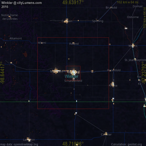
Analysis of Winkler night lights 2016
Square area 10x10 km:
 2.52%
2.52%90-99
4.2%80-89
2.38%70-79
1.82%60-69
3.5%50-59
2.1%40-49
1.68%30-39
3.5%20-29
0.84%10-19
21.85%0-9
55.6%Square area 50x50 km:
0.13%90-99
0.25%80-89
0.15%70-79
0.1%60-69
0.22%50-59
0.26%40-49
0.2%30-39
0.32%20-29
0.12%10-19
0.96%0-9
97.29%Clear (daylight) street map image can be seen on geolist.org.
Map coordinates:
49° 38' 21" North, 98° 38' 39" West
49° 10' 54.1" North, 97° 56' 27.7" West
48° 43' 11.9" North, 97° 14' 16.5" West
Some cities around Winkler sort by population:
• Winnipeg
96.9 km =60.2 mi,  36°
36°
• Grand Forks, US
154.9 km =96.3 mi,  154°
154°
• Portage la Prairie
91.5 km =56.9 mi,  343°
343°
• Selkirk
131.2 km =81.5 mi, 35°
• Steinbach
98.7 km =61.3 mi,  67°
67°
• East Grand Forks, US
154.7 km =96.1 mi, 154°
• Devils Lake, US
136.9 km =85.1 mi,  209°
209°
• Morden
11.7 km =7.3 mi,  275°
275°
6183204 (p: 8,270)
Sources (retrieved 2019-11-25):
» Earth at Night: Flat Maps 2012, 2016