Vanier night lights from space
Night Light of Vanier (Ontario) from space (Canada) Src. Average luminocity for 10x10km area is 89.6746% and for 50x50km: 28.2914%.
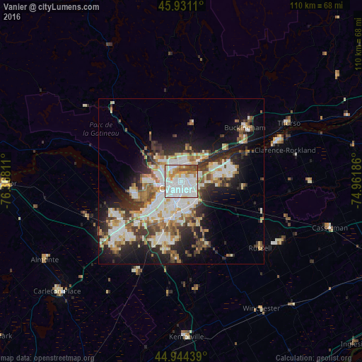
Analysis of Vanier night lights 2016
Square area 10x10 km:
 45.87%
90-99
24.76%80-89
6.67%70-79
7.78%60-69
5.87%50-59
3.97%40-49
5.08%30-39
0%20-29
0%10-19
0%0-9
0%Square area 50x50 km:
6.36%90-99
6.46%80-89
3.46%70-79
2.85%60-69
3.27%50-59
3.18%40-49
3.19%30-39
4.27%20-29
6.58%10-19
10.81%0-9
49.58%Clear (daylight) street map image can be seen on geolist.org.
Map coordinates:
45° 55' 52" North, 76° 22' 5.2" West
45° 26' 23.6" North, 75° 39' 53.9" West
44° 56' 39.8" North, 74° 57' 42.7" West
Some cities around Vanier sort by population:
• Ottawa
4.1 km =2.5 mi,  218°
218°
• Gatineau
5 km =3.1 mi,  325°
325°
• Nepean
12.4 km =7.7 mi,  201°
201°
• Fallingbrook
14.7 km =9.1 mi,  74°
74°
• le Plateau
9 km =5.6 mi,  266°
266°
• Queenswood Heights
12.9 km =8 mi, 74°
• Cantley
16.8 km =10.4 mi, 326°
• Bells Corners
18.9 km =11.7 mi, 223°
6173404 (p: 17,000)
Sources (retrieved 2019-11-25):
» Earth at Night: Flat Maps 2012, 2016