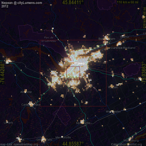
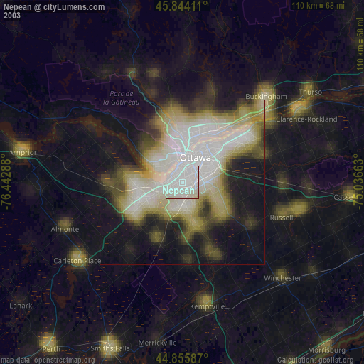
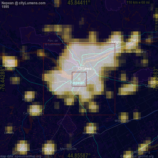
Nepean night lights from space
Night Light of Nepean (Ontario) from space (Canada) Src. Average luminocity for 10x10km area is 85.9556% and for 50x50km: 28.3019%.
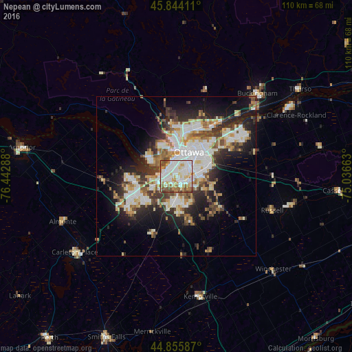
Analysis of Nepean night lights 2016
Square area 10x10 km:
 31.11%
90-99
27.78%80-89
10.32%70-79
9.37%60-69
10.16%50-59
5.87%40-49
5.4%30-39
0%20-29
0%10-19
0%0-9
0%Square area 50x50 km:
6.4%90-99
6.52%80-89
3.38%70-79
2.95%60-69
3.25%50-59
2.99%40-49
3.18%30-39
4.22%20-29
6.75%10-19
10.81%0-9
49.54%Clear (daylight) street map image can be seen on geolist.org.
Map coordinates:
45° 50' 38.8" North, 76° 26' 34.4" West
45° 20' 10.3" North, 75° 43' 21" West
44° 51' 21.1" North, 75° 2' 11.9" West
Some cities around Nepean sort by population:
• Ottawa
8.6 km =5.3 mi,  12°
12°
• Gatineau
15.8 km =9.8 mi, 5°
• Kanata
15.7 km =9.8 mi,  255°
255°
• Fallingbrook
24.2 km =15 mi,  50°
50°
• Vanier
12.4 km =7.7 mi,  21°
21°
• le Plateau
11.9 km =7.4 mi,  337°
337°
• Queenswood Heights
22.6 km =14 mi, 48°
• Bells Corners
8.7 km =5.4 mi,  254°
254°
6087029 (p: 180,000)
Sources (retrieved 2019-11-25):
» NASA, Earths city lights 1995
» NASA city lights 2003
» Earth at Night: Flat Maps 2012, 2016