Thompson night lights from space
Night Light of Thompson (Manitoba) from space (Canada) Src. Average luminocity for 10x10km area is 19.8278% and for 50x50km: 0.8726%.
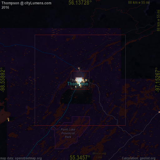
Analysis of Thompson night lights 2016
Square area 10x10 km:
 4.67%
4.67%90-99
4.78%80-89
1.56%70-79
0.48%60-69
1.91%50-59
2.03%40-49
0.36%30-39
1.08%20-29
2.03%10-19
24.28%0-9
56.82%Square area 50x50 km:
0.19%90-99
0.19%80-89
0.06%70-79
0.02%60-69
0.08%50-59
0.1%40-49
0.01%30-39
0.06%20-29
0.1%10-19
0.98%0-9
98.2%Clear (daylight) street map image can be seen on geolist.org.
Map coordinates:
56° 8' 14.2" North, 98° 33' 32.1" West
55° 44' 36.6" North, 97° 51' 20.8" West
55° 20' 44.5" North, 97° 9' 9.6" West
Some cities around Thompson sort by population:
• Prince Albert
583.7 km =362.7 mi,  241°
241°
• Yorkton
588.3 km =365.6 mi,  211°
211°
• Selkirk
626 km =389 mi,  174°
174°
• Dauphin
531 km =329.9 mi,  195°
195°
• The Pas
304.9 km =189.5 mi,  225°
225°
• Flin Flon
276.8 km =172 mi,  246°
246°
• Melfort
542.5 km =337.1 mi, 233°
• La Ronge
473.9 km =294.5 mi,  261°
261°
6165406 (p: 12,467)
Sources (retrieved 2019-11-25):
» Earth at Night: Flat Maps 2012, 2016