The Pas night lights from space
Night Light of The Pas (Manitoba) from space (Canada) Src. Average luminocity for 10x10km area is 9.1508% and for 50x50km: 0.3806%.
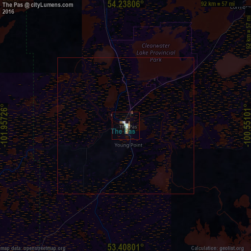
Analysis of The Pas night lights 2016
Square area 10x10 km:
 1.46%
1.46%90-99
1.85%80-89
0.4%70-79
1.59%60-69
0%50-59
1.59%40-49
1.85%30-39
0.53%20-29
0.53%10-19
1.59%0-9
88.62%Square area 50x50 km:
0.06%90-99
0.07%80-89
0.02%70-79
0.06%60-69
0%50-59
0.07%40-49
0.07%30-39
0.04%20-29
0.02%10-19
0.09%0-9
99.5%Clear (daylight) street map image can be seen on geolist.org.
Map coordinates:
54° 14' 17" North, 101° 57' 26.1" West
53° 49' 30.3" North, 101° 15' 14.9" West
53° 24' 28.8" North, 100° 33' 3.6" West
Some cities around The Pas sort by population:
• Prince Albert
306.4 km =190.4 mi,  256°
256°
• Yorkton
301.4 km =187.3 mi,  195°
195°
• Thompson
304.9 km =189.5 mi,  45°
45°
• Warman
392.5 km =243.9 mi,  244°
244°
• Dauphin
308.5 km =191.7 mi,  164°
164°
• Flin Flon
112.2 km =69.7 mi,  338°
338°
• Melfort
247.4 km =153.7 mi, 244°
• La Ronge
296.5 km =184.2 mi,  298°
298°
6164499 (p: 6,055)
Sources (retrieved 2019-11-25):
» Earth at Night: Flat Maps 2012, 2016