Trois-Rivières night lights from space
Night Light of Trois-Rivières (Quebec) from space (Canada) Src. Average luminocity for 10x10km area is 61.3973% and for 50x50km: 8.6976%.
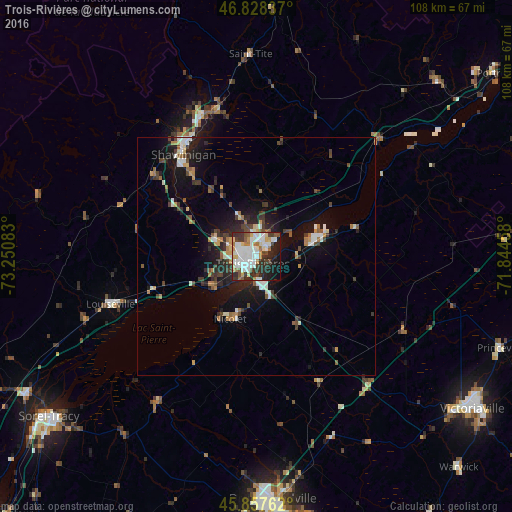
Analysis of Trois-Rivières night lights 2016
Square area 10x10 km:
 18.9%
18.9%90-99
18.3%80-89
4.32%70-79
5.95%60-69
5.36%50-59
4.17%40-49
5.95%30-39
9.52%20-29
12.65%10-19
12.95%0-9
1.93%Square area 50x50 km:
1.26%90-99
1.62%80-89
0.55%70-79
0.97%60-69
0.98%50-59
0.87%40-49
1.34%30-39
1.55%20-29
2.65%10-19
6.35%0-9
81.88%Clear (daylight) street map image can be seen on geolist.org.
Map coordinates:
46° 49' 42.1" North, 73° 15' 3" West
46° 20' 42.5" North, 72° 32' 51.7" West
45° 51' 27.4" North, 71° 50' 40.5" West
Some cities around Trois-Rivières sort by population:
• Drummondville
51.6 km =32.1 mi,  174°
174°
• Sorel-Tracy
55.1 km =34.2 mi,  232°
232°
• Shawinigan
29.1 km =18.1 mi,  327°
327°
• Sainte-Catherine
3.3 km =2.1 mi,  205°
205°
• Bécancour
8.9 km =5.5 mi,  92°
92°
• Louiseville
31.8 km =19.8 mi,  251°
251°
• Princeville
55.2 km =34.3 mi,  110°
110°
• Nicolet
15.2 km =9.4 mi,  200°
200°
6169141 (p: 119,693)
Sources (retrieved 2019-11-25):
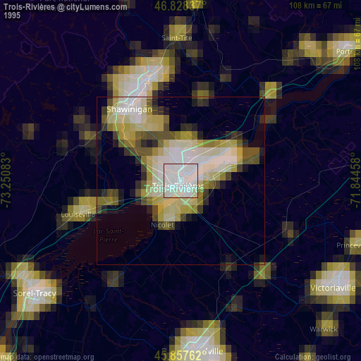
» NASA, Earths city lights 1995
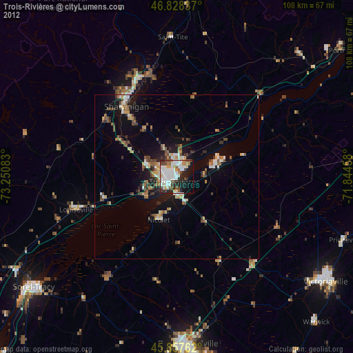
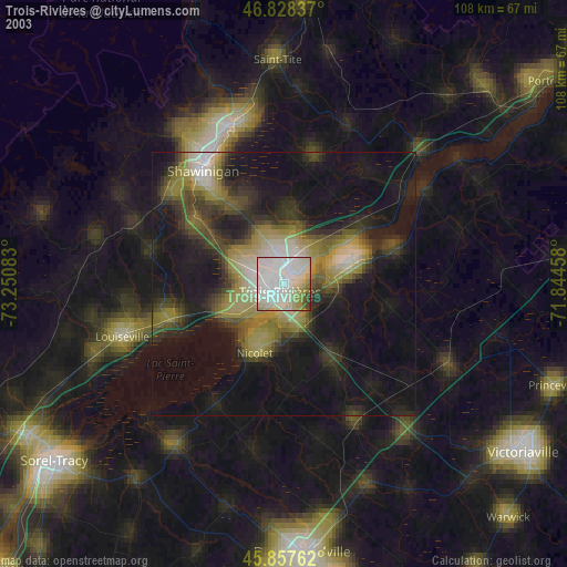
» NASA city lights 2003
» Earth at Night: Flat Maps 2012, 2016