Parksville night lights from space
Night Light of Parksville (British Columbia) from space (Canada) Src. Average luminocity for 10x10km area is 14.1043% and for 50x50km: 2.2735%.
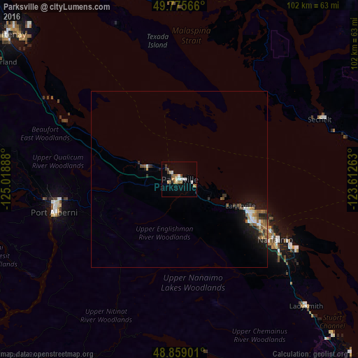
Analysis of Parksville night lights 2016
Square area 10x10 km:
 1.74%
1.74%90-99
2.54%80-89
1.07%70-79
2.01%60-69
2.54%50-59
1.87%40-49
1.6%30-39
1.07%20-29
0%10-19
4.14%0-9
81.42%Square area 50x50 km:
0.26%90-99
0.32%80-89
0.12%70-79
0.25%60-69
0.39%50-59
0.41%40-49
0.39%30-39
0.27%20-29
0.4%10-19
1.78%0-9
95.41%Clear (daylight) street map image can be seen on geolist.org.
Map coordinates:
49° 46' 32.4" North, 125° 1' 8" West
49° 19' 10.1" North, 124° 18' 56.7" West
48° 51' 32.4" North, 123° 36' 45.5" West
Some cities around Parksville sort by population:
• Nanaimo
32.1 km =19.9 mi,  121°
121°
• Courtenay
63.7 km =39.6 mi,  309°
309°
• North Cowichan
70.2 km =43.6 mi,  139°
139°
• Port Alberni
36.4 km =22.6 mi,  256°
256°
• Powell River
59 km =36.7 mi,  345°
345°
• Sechelt
43.8 km =27.2 mi,  66°
66°
• Ladysmith
51.5 km =32 mi, 135°
• Gibsons
59.3 km =36.8 mi,  81°
81°
6098642 (p: 12,000)
Sources (retrieved 2019-11-25):
» Earth at Night: Flat Maps 2012, 2016