Ladysmith night lights from space
Night Light of Ladysmith (British Columbia) from space (Canada) Src. Average luminocity for 10x10km area is 6.4643% and for 50x50km: 3.2751%.
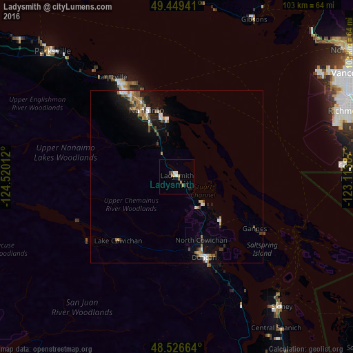
Analysis of Ladysmith night lights 2016
Square area 10x10 km:
 0.6%
0.6%90-99
1.19%80-89
0.6%70-79
1.19%60-69
1.19%50-59
0.74%40-49
0.74%30-39
0.3%20-29
0.74%10-19
1.64%0-9
91.07%Square area 50x50 km:
0.44%90-99
0.44%80-89
0.23%70-79
0.37%60-69
0.6%50-59
0.51%40-49
0.47%30-39
0.39%20-29
0.4%10-19
2.8%0-9
93.34%Clear (daylight) street map image can be seen on geolist.org.
Map coordinates:
49° 26' 57.9" North, 124° 31' 12.4" West
48° 59' 24.6" North, 123° 49' 1.2" West
48° 31' 35.9" North, 123° 6' 49.9" West
Some cities around Ladysmith sort by population:
• Richmond
53.4 km =33.2 mi,  68°
68°
• Nanaimo
21.5 km =13.4 mi,  335°
335°
• North Cowichan
19.1 km =11.9 mi,  149°
149°
• Duncan
24.5 km =15.2 mi,  160°
160°
• Parksville
51.5 km =32 mi,  315°
315°
• North Saanich
46.3 km =28.8 mi,  141°
141°
• Salt Spring Island
30.5 km =19 mi,  128°
128°
• Gibsons
50.4 km =31.3 mi,  26°
26°
6047817 (p: 8,740)
Sources (retrieved 2019-11-25):
» Earth at Night: Flat Maps 2012, 2016