Kingston night lights from space
Night Light of Kingston (Ontario) from space (Canada) Src. Average luminocity for 10x10km area is 44.0939% and for 50x50km: 4.5383%.
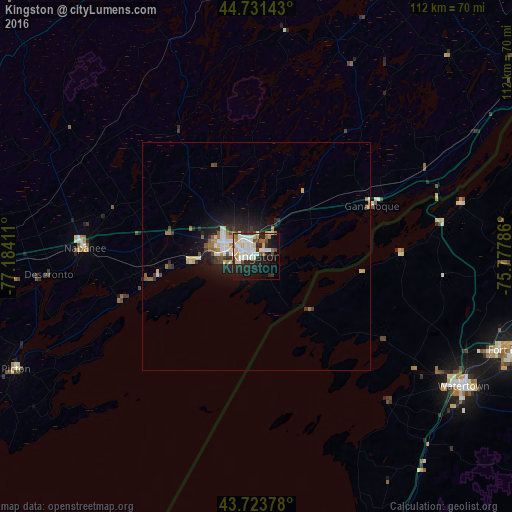
Analysis of Kingston night lights 2016
Square area 10x10 km:
 11.06%
90-99
12.73%80-89
6.06%70-79
2.12%60-69
2.73%50-59
3.03%40-49
4.24%30-39
2.88%20-29
14.7%10-19
23.48%0-9
16.97%Square area 50x50 km:
0.67%90-99
0.99%80-89
0.6%70-79
0.34%60-69
0.46%50-59
0.44%40-49
0.48%30-39
0.57%20-29
1.51%10-19
3.26%0-9
90.69%Clear (daylight) street map image can be seen on geolist.org.
Map coordinates:
44° 43' 53.1" North, 77° 11' 2.8" West
44° 13' 47.1" North, 76° 28' 51.5" West
43° 43' 25.6" North, 75° 46' 40.3" West
Some cities around Kingston sort by population:
• Belleville
72.2 km =44.9 mi,  264°
264°
• Watertown, US
53.6 km =33.3 mi,  121°
121°
• Prince Edward
66.4 km =41.3 mi,  247°
247°
• Brockville
74.8 km =46.5 mi,  57°
57°
• Greater Napanee
37.4 km =23.2 mi,  273°
273°
• Fort Drum, US
60.5 km =37.6 mi,  108°
108°
• Napanee
37.4 km =23.2 mi, 273°
• Gananoque
27.6 km =17.1 mi,  65°
65°
5992500 (p: 114,195)
Sources (retrieved 2019-11-25):
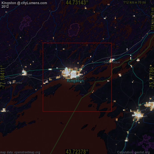
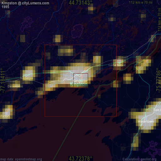
» NASA, Earths city lights 1995
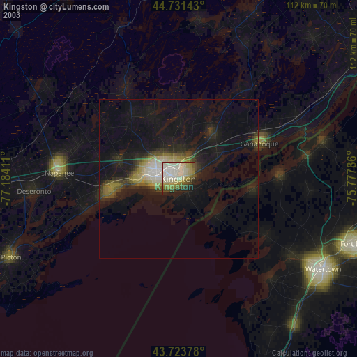
» NASA city lights 2003
» Earth at Night: Flat Maps 2012, 2016